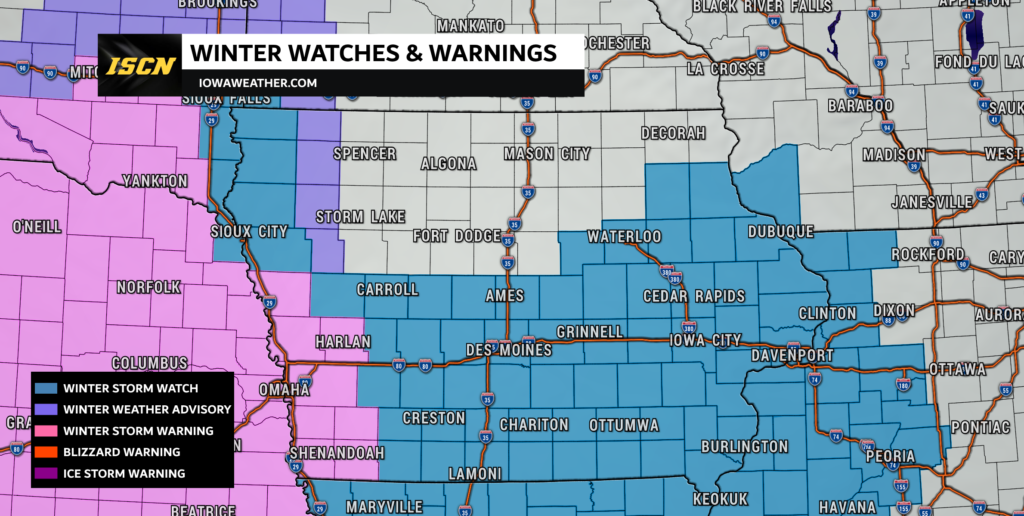
Winter Storm Watch Issued for Portions of Iowa Early Next Week

Iowans are gearing up for a substantial snowfall that is set to blanket the state from early Monday morning through Tuesday afternoon. The National Weather Service has issued a Winter Storm Watch, indicating the potential for moderate to heavy snowfall and the likelihood of challenging travel conditions. Residents across western Iowa, southern Iowa, central Iowa, east central, northeast, and southeast Iowa are urged to stay informed and prepared for the impending winter weather.
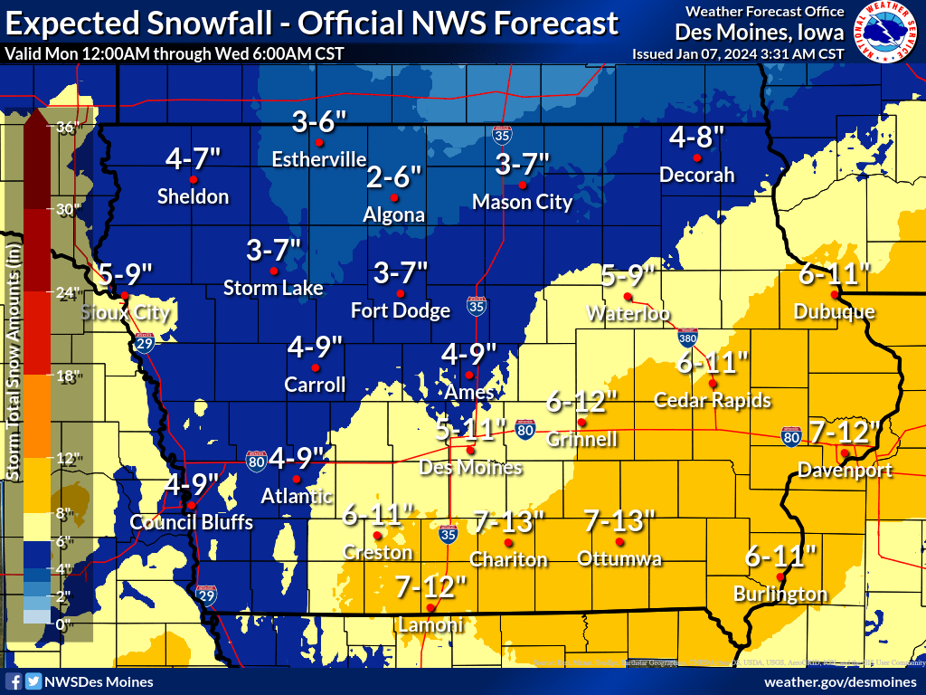
Snowfall Projections:
The forecast predicts a widespread accumulation of 5 to 10 inches or more across a large part of Iowa, with total snow accumulations of 6 to 12 inches possible across the southeast half of Iowa. This significant snowfall may lead to hazardous road conditions and travel disruptions. Commuters are advised to exercise caution and plan accordingly to ensure their safety during the storm.

Timing and Duration:
The winter storm is expected to commence early Monday morning and persist until Tuesday afternoon/evening. The prolonged duration of snowfall raises concerns about the accumulation of snow on roadways and surfaces, making it essential for residents to stay updated on weather conditions and heed any advisories or warnings.
Wind Gusts and Drifting Snow:
As the snowfall begins to taper off on Tuesday afternoon, a new challenge emerges in the form of strong winds. Gusts of 35 to 40 mph or greater are anticipated, potentially causing blowing and drifting snow. This combination of heavy snowfall and high winds can reduce visibility and create hazardous conditions for both drivers and pedestrians. It is crucial for individuals to remain vigilant and take necessary precautions to avoid accidents and emergencies.
Preparedness Tips
- Monitor Weather Updates: Stay informed about the latest weather forecasts and updates from reliable sources. This will help you make informed decisions about travel plans and preparations.
- Winterize Your Vehicle: Ensure your vehicle is equipped for winter conditions. Check your tires, brakes, and fluid levels. Keep an emergency kit in your car with essentials like blankets, snacks, and a flashlight.
- Plan Travel Accordingly: If possible, consider delaying or rescheduling travel plans during the peak of the storm. If travel is unavoidable, plan for extra time and drive cautiously.
- Stay Indoors: If conditions become severe, the safest option is to stay indoors. Postpone non-essential outings until roads are cleared and conditions improve.
- Prepare Your Home: Stock up on essentials like food, water, and medications. Keep your home warm and draft-free, and ensure you have adequate heating fuel.
Be sure to get the latest winter storm updates by downloading the ISCN Weather App, or by checking out your local forecast on our weather forecast page.