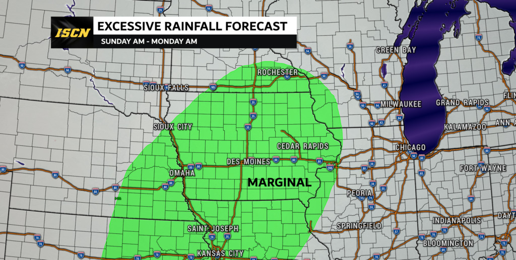
The weather pendulum is going to swing back the other direction, and it will feel more like our third spring as we head into the weekend. Temperatures are going to be warming up, and then a strong area of low pressure will move into the state Sunday evening, bringing heavy rain and strong winds.
Saturday Weather Forecast
On Saturday, high temperatures will range from the low 30s in northern Iowa where the snowpack will hold their temperatures down, to the mid to upper 40s across southern Iowa. Saturday will also be a mostly sunny day across the state of Iowa.
Sunday Weather Forecast
Sunday will start out clear, dry, and warm. But as the afternoon goes on, clouds will start to increase from south to north as an area of low pressure begins to approach the state. Highs on Sunday will range from near 40 degrees across northern Iowa to the mid to upper 50s across southern Iowa. After 6PM, rain will start to move into far southwest Iowa. This rain will continue to track off to the northeast through the overnight hours. Rainfall rates during the overnight could be moderate to heavy at times. Even a few rumbles of thunder will be possible.

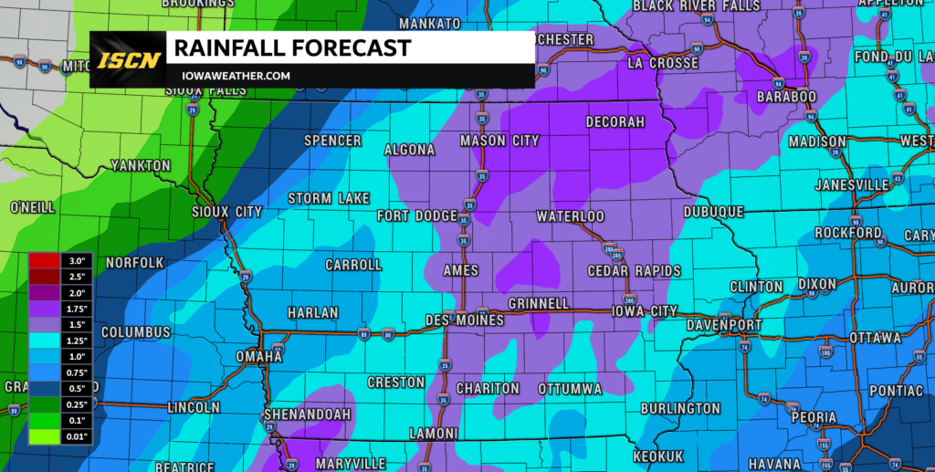
Rain will continue into the day on Monday, before tapering off by Monday afternoon. Rainfall amounts will range from 1 to 2 inches across the state, with lesser amounts across far southeast and far northwest Iowa. With these rainfall amounts, there is some concern for minor flooding and field ponding.
Strong wind gusts will be expected from early Monday through Monday evening. These winds may hit wind advisory criteria, so an advisory may be issued during that timeframe for the strong winds that will be expected.
The Extended Forecast
Temperatures on Monday will range from the upper 30s across northwest Iowa to the upper 50s across southwest Iowa. Temperatures will cool slightly into Tuesday with highs in the upper 30s across northern Iowa to near 50 across southern Iowa. Temperatures will then rebound slightly into Wednesday. Highs will range from the upper 30s across northern Iowa to near 60 across southeast Iowa. After Wednesday, temperatures will begin to cool into Thursday. This is when highs will range from the upper 20s across northern Iowa to the low 40s across southern Iowa.
Continue to stay up to date with the latest weather forecast for you local area. Be sure to download our ISCN Weather App from the Android and Apple store. There you can find the latest seven day weather forecast, hour-by-hour forecast, and interactive radar and future radar! It will also send you any alerts for watches/warnings issued for your current location.