Weather System to Bring Rain, Freezing Rain, and Snow to Iowa

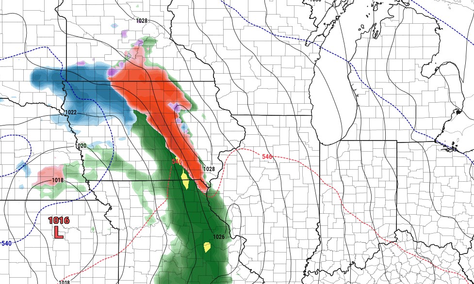
As we move closer to the heart of winter, Iowa is gearing up for a complex and potentially impactful weather system set to arrive this Friday into Saturday. A low-pressure system will develop in the central Plains, bringing a variety of precipitation types across the state. Here’s what you need to know to prepare for the upcoming winter weather.
Timeline of Events
- Friday Afternoon: Precipitation is expected to begin, initially as freezing drizzle or freezing rain across southern and central Iowa. However, before precipitation starts, the atmosphere will need to saturate from the top down, resulting in lighter initial amounts. Temperatures south of Interstate 80 may warm close to or above freezing, which could quickly transition precipitation to rain in those areas. For much of the state, the daytime impacts will be very little.
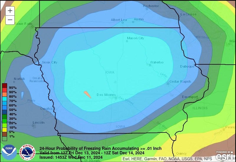
- Friday Evening: As the evening progresses, precipitation will become more widespread. Areas north of Interstate 80 are likely to see freezing rain, while locations to the south will transition to rain as warm air moves into the region. Warmer air aloft will initially support freezing rain, particularly north of Interstate 80, before ground-level temperatures rise, facilitating the changeover to rain. Ice accumulation south of Interstate 80 is expected to remain minor, generally under 0.1 inches. However, there is a moderate risk of slightly higher accumulations across northern Iowa.
- Saturday Morning: Precipitation will continue to persist, with a mix of freezing rain and snow continuing in far northern Iowa. In central Iowa, freezing rain will transition entirely to rain as temperatures rise above freezing. Snow totals will remain minimal across northern Iowa, with accumulations of less than an inch.
- Saturday Afternoon: Rain will taper off from west to east throughout the afternoon hours.

Precipitation Breakdown by Region
- Southern Iowa (South of I-80): Rain is the dominant precipitation type as surface temperatures rise. Little to no ice accumulation is expected here.
- Central Iowa (I-80 Corridor): A period of freezing rain is likely before temperatures climb above freezing overnight. Ice accumulation of 0.1 to 0.15 inches could make roads slippery.
- Northern Iowa (Highway 20 and North): Snow is expected initially, with accumulations up to 1 inch possible. A transition to freezing rain and sleet could create icy conditions.
Impacts to Watch For
- Road Conditions: Freezing rain along the I-80 corridor could create slick roads during the Friday evening commute. Drivers are advised to monitor conditions and travel cautiously.
- Power Lines and Trees: With ice accumulations up to 0.2 inches in some areas, isolated power outages and minor tree damage are possible.
- Morning Commutes: Slick spots are likely Saturday morning, especially in northern Iowa, before temperatures rise above freezing.
Uncertainty Remains
Forecast models continue to refine the exact track of the low-pressure system. A slight northward shift could reduce icing along I-80, while a southward shift might increase snow potential. Additionally, temperature profiles will determine the type and extent of wintry precipitation. Stay updated with the latest details on our current weather forecast page, on our Facebook and X pages, as well as IowaWeather.com.