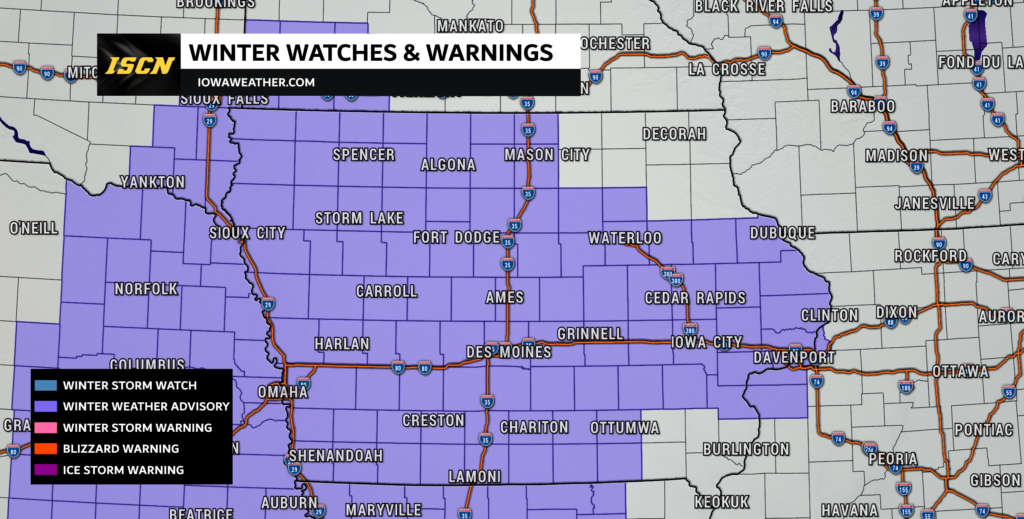
Winter Weather Advisory Issued for Iowa Ahead of Freezing Rain

As Iowa braces for the arrival of a winter storm late Friday into Saturday, the National Weather Service (NWS) has issued Winter Weather Advisories across the state. This storm is expected to bring a mix of freezing rain, sleet, and rain, leading to hazardous travel conditions and potential icing impacts.
Detailed Weather Breakdown
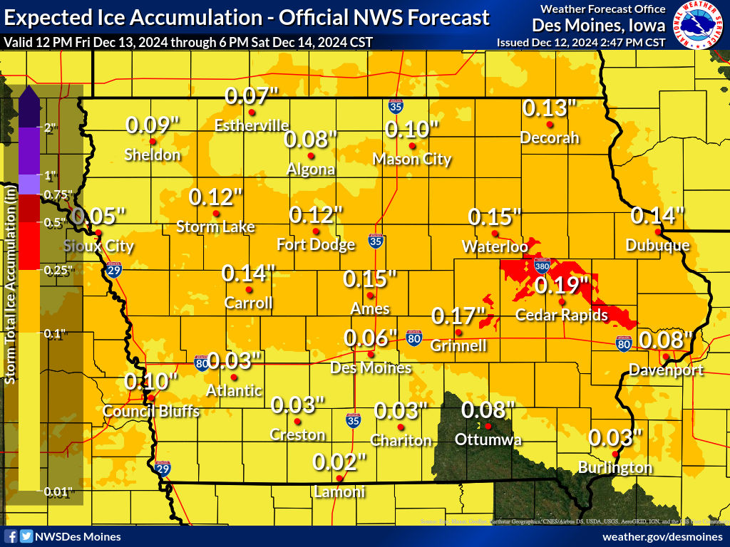
A significant winter weather event is set to impact Iowa starting late Friday and continuing into Saturday morning. Precipitation is expected to begin as freezing rain across much of the state Friday evening. Ice accumulations will range from around one-tenth to two-tenths of an inch, with the highest amounts expected north of Interstate 80. The freezing rain may mix with sleet or snow in some areas, though total snow and sleet accumulations are expected to remain under an inch.
Temperatures will play a critical role in the type and duration of precipitation. Surface temperatures below freezing in central and northern Iowa will allow ice to form on untreated surfaces, making roads, bridges, and overpasses particularly hazardous. Warmer air will gradually move in from the south overnight, causing a transition to rain in southern and central Iowa by Saturday morning. However, the northern part of the state, especially near and north of Highway 20, may experience prolonged freezing rain and the most impactful ice accumulations.

By Saturday afternoon, much of the precipitation is expected to turn to rain as temperatures rise above freezing across the state, helping to melt any accumulated ice. However, lingering icy conditions may persist into Saturday morning, especially in areas where ground temperatures remain below freezing. Drivers should anticipate slick roads and challenging travel conditions Friday night into early Saturday, particularly in the northern half of the state.
- Precipitation Timing:
Most areas will remain dry during the day Friday, with precipitation developing late in the afternoon or evening in southwest Iowa and spreading across the state overnight. - Icing Potential:
Significant ice accumulations are expected north of I-80, particularly along the Highway 20 corridor, where totals could approach 0.1 to 0.2 inches. Untreated roads and surfaces will be especially slick. - Transition to Rain:
As warmer air pushes in, freezing rain will transition to rain from south to north by Saturday morning, limiting the duration of icy conditions.
Looking Ahead
While conditions will improve Saturday as temperatures rise above freezing, roads may remain slick in the morning. Fortunately, a milder Sunday is expected, with highs in the mid-30s to low 40s, which should help melt any lingering ice.
Weather conditions can change rapidly, so make sure to stay tuned to the Iowa Storm Chasing Network for the latest updates. Follow us on our Facebook and X (formerly Twitter) social media pages for real-time alerts and insights. For detailed forecasts and weather information, visit our current weather forecast page.