A strong spring storm system is expected to bring the potential for severe weather across much of Iowa and the surrounding region on Monday. All the right ingredients are coming together to support the development of severe thunderstorms, including the potential for strong tornadoes, as highlighted in the latest Storm Prediction Center (SPC) forecast discussion on Friday.
The wind profile supports supercells capable of all severe weather hazards including the potential for strong tornadoes. – SPC Forecast Discussion 4/25/2025
What’s Coming Together?
On Monday, strong winds high in the atmosphere will race from the Southwest into the Upper Midwest. This surge of high-altitude winds will help energize the atmosphere. As this happens, a surface low pressure system will intensify over the northern Plains and track toward the northern Great Lakes.

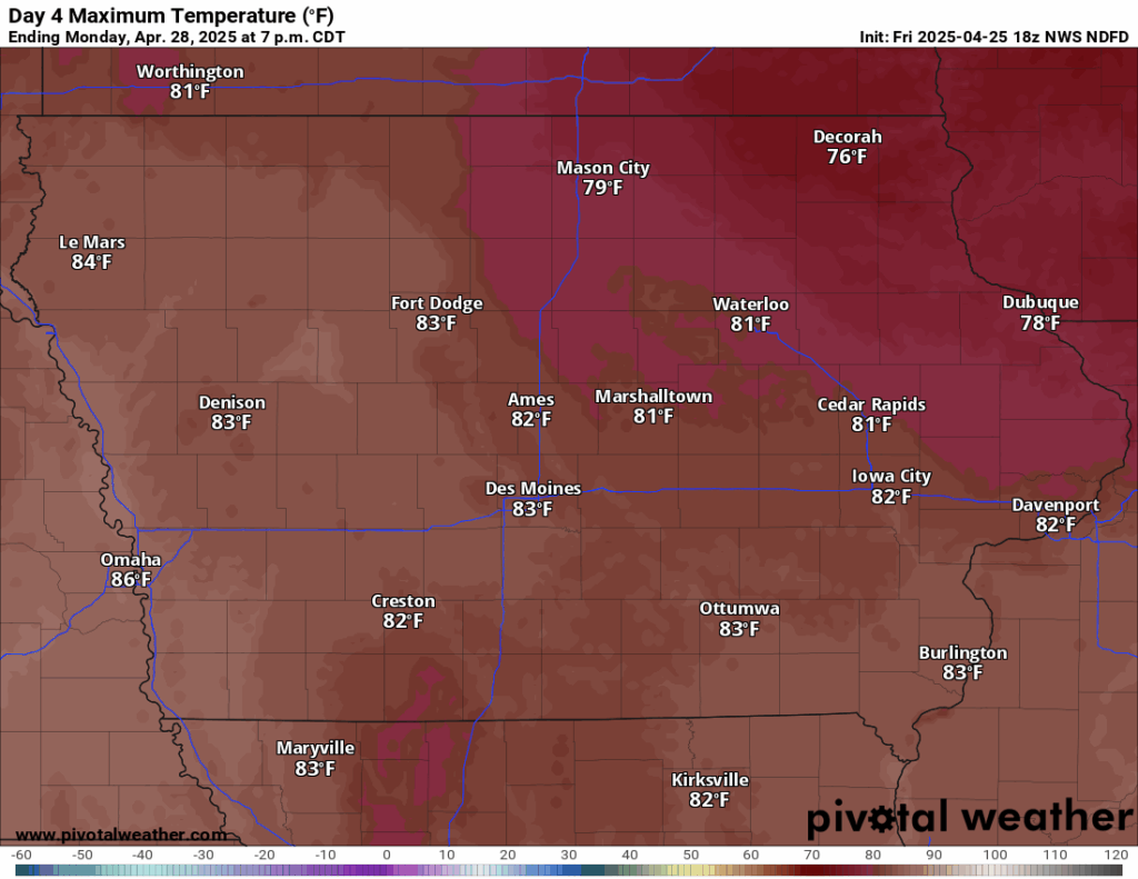
At the same time, warm, moist air from the Gulf will surge northward into the region. As a result, we’ll see high temperatures in the upper 70s to low 80s and dew points in the 60s, creating a very unstable environment.
The combination of strong wind shear, instability, and lift will set the stage for severe thunderstorm development. If storms form in the warm sector (ahead of the cold front), they could become supercells — capable of producing all modes of severe weather.
What to Expect
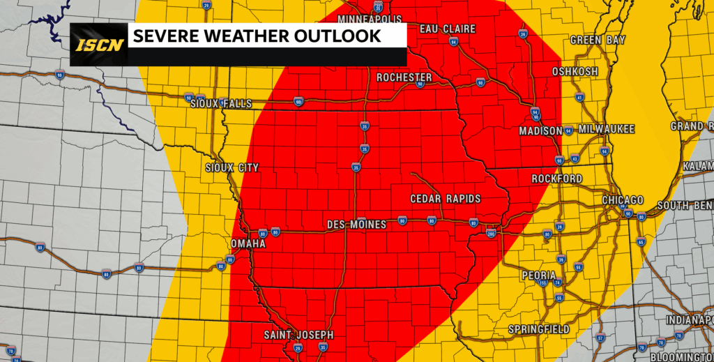
The Storm Prediction Center’s (SPC) Day 4 Outlook places much of Iowa under a 30% probability for severe weather on Monday. This 30% probability is roughly equivalent to an Enhanced Risk, or Level 3 out of 5, on the standard severe weather scale. According to their latest forecast discussion, the environment on Monday will be supportive of supercells capable of all severe weather hazards — including the potential for strong tornadoes.
The area of greatest concern stretches from eastern Kansas and northern Missouri through Iowa into southern Minnesota and western Wisconsin.
While a few storms may pop up early in the day (particularly across northern Iowa), the main round of severe storms is expected later in the afternoon and evening. The exact timing and location of storms remain uncertain and will depend on how storms interact with the advancing cold front.
However, where and when the storms form matters a lot:
- If storms form ahead of the cold front in the warm, humid air, they could quickly become powerful supercells capable of producing large hail, damaging winds, and tornadoes.
- If storms mainly develop behind the cold front, they would be more clustered or linear, leading to a greater threat for damaging winds and heavy rain, but a lower tornado risk.
Right now, forecast guidance suggests the biggest severe threat will be later in the afternoon and evening, but the exact timing will be key — and we’ll be watching it closely.
Stay Weather Aware
Forecast confidence and detail will continue to improve as we get closer to Monday and more high-resolution model data becomes available. The Iowa Storm Chasing Network will be watching this setup closely and sharing updates throughout the weekend.
What You Can Do Now:
- Make sure your weather alerts are turned on
- Review your tornado safety plan
- Follow trusted weather sources for the latest info
Excellent information! This sounds like a pretty big storm!