Snowfall Likely for Parts of Iowa Saturday

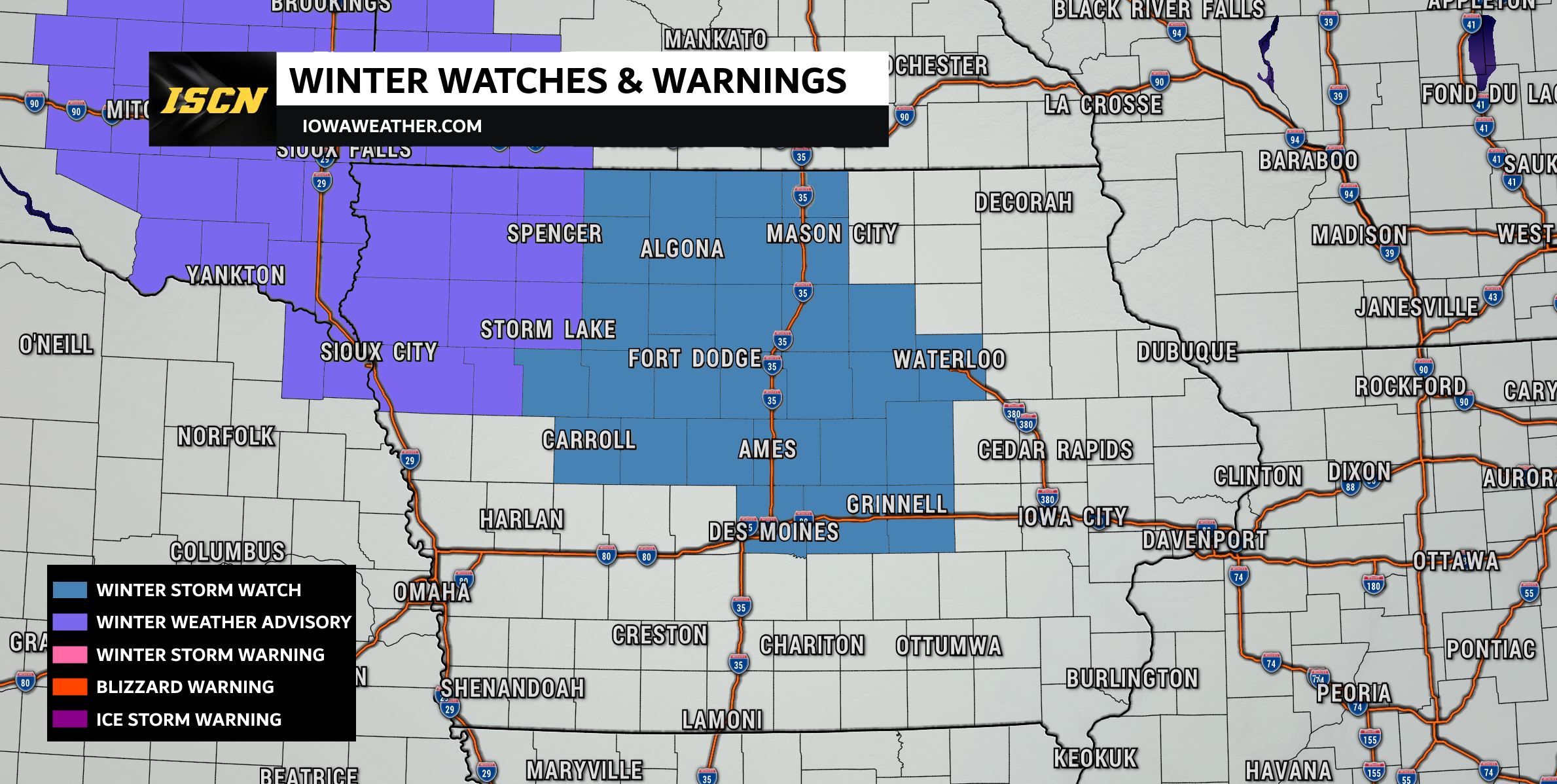
A developing winter storm will bring a widespread swath of snow across northern Iowa Saturday afternoon into Saturday night, with travel impacts likely in the watch and advisory areas. The National Weather Service has issued both a Winter Storm Watch and a Winter Weather Advisory for portions of northern Iowa as confidence continues to increase in accumulating snowfall.
Snow Timing: When It Arrives and Moves Through the State
Snow will begin to develop across northwest Iowa around noon on Saturday. As the system matures, snow will steadily spread southeast through the afternoon.
- I-35 Corridor (Des Moines to Ames to Mason City): Snow is expected to reach this region between 3 PM and 6 PM.
- Eastern Iowa: Snow moves into eastern parts of the state between 6 PM and 9 PM.
Snow will begin tapering off from west to east late Saturday night, and the system will fully exit Iowa by very early Sunday morning.
The timing of this storm means evening travel Saturday may be hazardous, especially across the northern half of Iowa.

Expected Snowfall Amounts
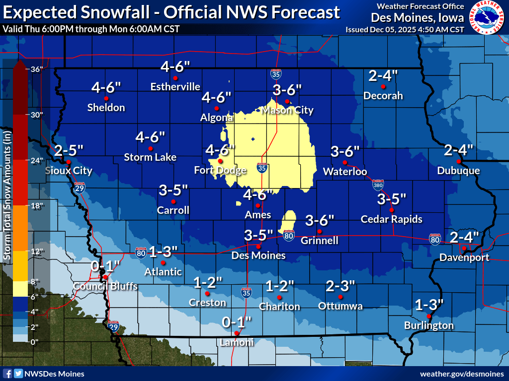
The National Weather Service highlights a band of heavier snow likely to set up across north-central Iowa, including areas just north of Ames, near Fort Dodge, up toward Mason City, and just west of Waterloo. This zone has the best chance to see 5 to 7 inches of snow.
Across a large portion of northern Iowa, snowfall totals of 3 to 6 inches are expected. Slick and snow-covered roads will be common within this region.
Farther south, areas south of I-80 can expect lighter amounts, and far southwest Iowa will likely see little to no accumulation.
Track Still Uncertain
While confidence continues to grow in a widespread snow event, there remains some uncertainty in the exact storm track.
The latest model trends are shifting slightly farther north. If this trend continues, the heavier snowfall totals would also shift north, placing the highest impacts closer to the Minnesota border.
A slight change of 25–50 miles in storm track could significantly impact where the 5–7 inch band sets up.
We’ll continue to monitor this closely and provide updates as new data arrives.
Stay Tuned for Updates
This will be a fast-moving system, but snow coming during the afternoon and evening hours—paired with temperatures cold enough for accumulation—means travel impacts are likely for much of northern Iowa.
We’ll continue to update IowaWeather.com and ISCN social channels (Facebook & X) as new information becomes available.