Iowa Weather Forecast: Heavy Rain Ends Today Before a Warmer, Quieter Stretch Across Iowa
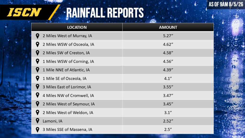
After several rounds of overnight thunderstorms, portions of southern Iowa will experience heavy rain through much of Wednesday. Rainfall is expected to persist in the region into the afternoon. The greatest concern remains along and south of Interstate 80, where repeated thunderstorms are capable of producing another 1 to 3 inches of rainfall, with isolated locations potentially exceeding 4 inches. While much of Iowa entered this event with relatively dry soils, repeated storms moving over the same locations could still lead to isolated flash flooding, especially in low-lying areas, urban locations, and places that received heavier rainfall Tuesday evening. Rain will gradually shift southeast during the afternoon before ending across southern Iowa by early evening. Travelers should remain alert for water-covered roads and rapidly changing conditions if thunderstorms move across their route.
Isolated Strong Storms Still Possible
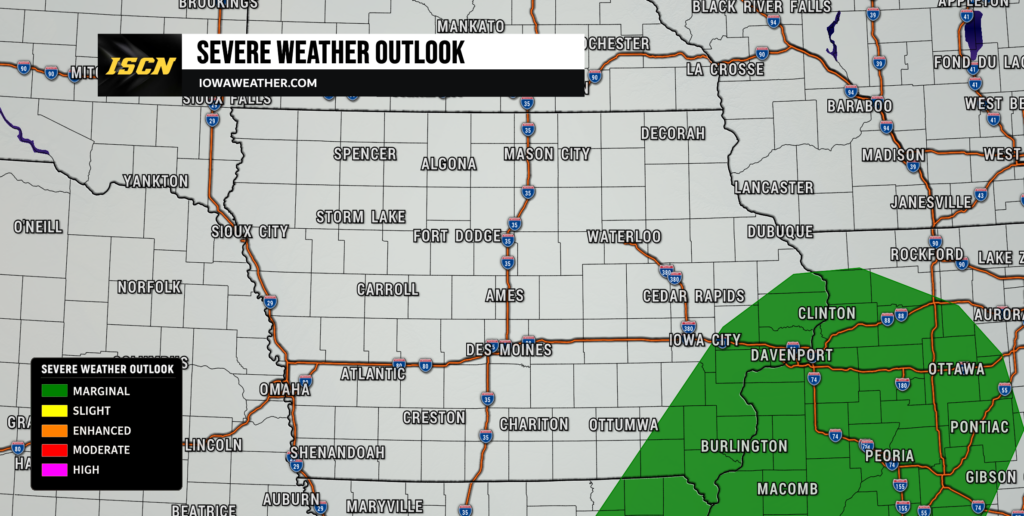
Although flooding is the primary concern, a few thunderstorms could become briefly strong this afternoon across southern and southeastern Iowa. The atmosphere will remain somewhat unstable where breaks in the clouds develop, allowing a few storms to produce wind gusts over 50 mph. While the overall severe weather threat is limited, lightning will accompany all thunderstorms, and an isolated small hail report or brief tornado cannot be completely ruled out. Most of central and northern Iowa will experience considerably less severe weather activity as cooler air continues filtering into the region. The severe weather threat should diminish quickly by this evening as the cold front pushes farther southeast.
Cooler, Comfortable Weather Returns Through Friday
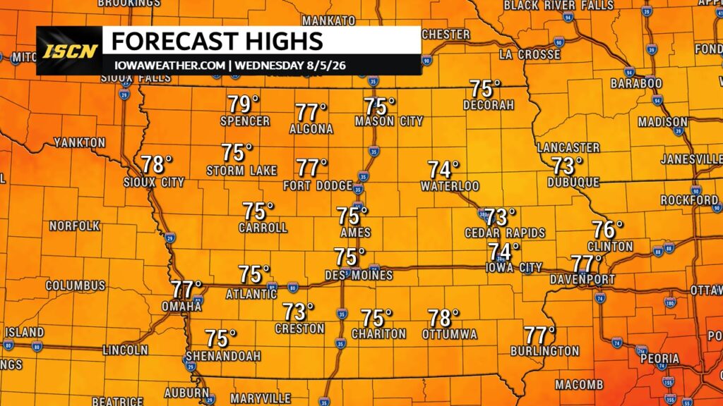
Once today’s storms exit, Iowa will enjoy a couple of days of much quieter weather. High pressure will settle across the Midwest, bringing lower humidity, comfortable overnight temperatures, and afternoon highs generally in the upper 70s to lower 80s. Overnight lows will even dip into the upper 40s and 50s across portions of northern Iowa, making for unusually pleasant August mornings. While an isolated shower cannot be ruled out Thursday or Friday, most communities will remain completely dry. Overall, this will be one of the more comfortable stretches of weather Iowa has experienced in recent weeks.
Weekend Warm-Up Begins Across Iowa
Temperatures will steadily climb as we head into the weekend. Southerly winds will return by Saturday, allowing highs to rise back into the middle and upper 80s, with some southern Iowa communities approaching 90 degrees by Sunday and early next week. Humidity will also gradually increase, although conditions are not expected to become excessively oppressive. The warming trend will be welcomed by many after several days of below-average temperatures. If you have outdoor plans this weekend, much of Saturday looks favorable before thunderstorm chances begin increasing later.
Thunderstorm Chances Return Late Weekend into Next Week
Forecast confidence decreases beyond Saturday as several weak disturbances begin moving through the northwesterly flow pattern over the Upper Midwest. Current forecast guidance suggests scattered thunderstorms may develop Saturday night, with additional opportunities Sunday night into Monday. It is still too early to determine exactly where the strongest storms or heaviest rainfall will occur, but the overall pattern favors periodic chances for showers and thunderstorms rather than continuous rain. Temperatures will remain seasonably warm, generally in the mid-80s to lower 90s, depending on cloud cover and where any storm boundaries develop.