Active Weather Pattern to Close Out July in Iowa: Heat, Heavy Rain & Severe Storms Possible
The end of July looks to be very active across Iowa, with a mix of heavy rainfall, severe weather potential, and building heat on the way. A series of systems and upper-level disturbances will sweep through the state beginning Friday, July 19, ushering in rounds of thunderstorms, some of which may be strong to severe, followed by a surge of dangerous heat next week.
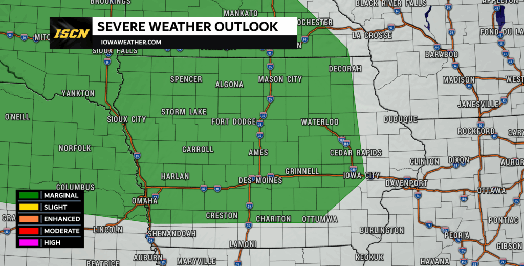
Friday, July 19: Heavy Rain and Severe Weather Threats Begin
Friday kicks off the unsettled pattern with a Marginal Risk of Severe Weather issued by the Storm Prediction Center (SPC) for much of central, western, and northern Iowa. Storms that do develop will have the potential to produce damaging winds, thanks to favorable mid-level wind shear and moderate instability.
Scattered thunderstorms look to develop northwest of Iowa Friday late afternoon and will merge into a line that tracks southeast into northwest Iowa after 10PM. This line, commonly known as a Mesoscale Convective System (MCS), will continue southeast through the state of Iowa during the early morning hours of Saturday.
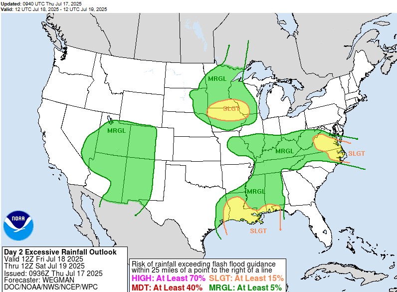
Meanwhile, the Weather Prediction Center (WPC) has outlined a Slight Risk of Excessive Rainfall for northern Iowa, with a Marginal Risk extending across the rest of the state. PWAT (precipitable water) values are expected to approach 2 inches, meaning storms that do form could be very efficient rain producers, leading to isolated flash flooding concerns.
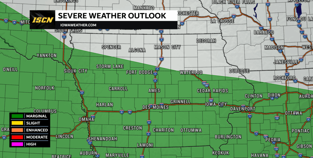
Saturday, July 20: More Storms and Heavy Rain
Saturday continues the active pattern, with another marginal risk of severe weather issued by the SPC, this time focused more across southern Iowa. The WPC has also extended a slight risk of excessive rainfall across northern and eastern Iowa.
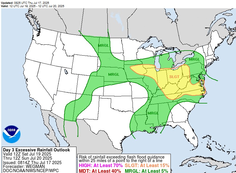
A cold front sagging south through the region, combined with lingering moisture and residual outflow boundaries from Friday’s storms, will act as a focus for additional thunderstorm development. Once again, damaging wind gusts look to be the primary severe threat, but heavy rainfall will remain a concern, particularly in areas that receive multiple rounds of storms. Similarly to Friday, these storms will develop and track across Iowa during the overnight hours Saturday into Sunday morning.
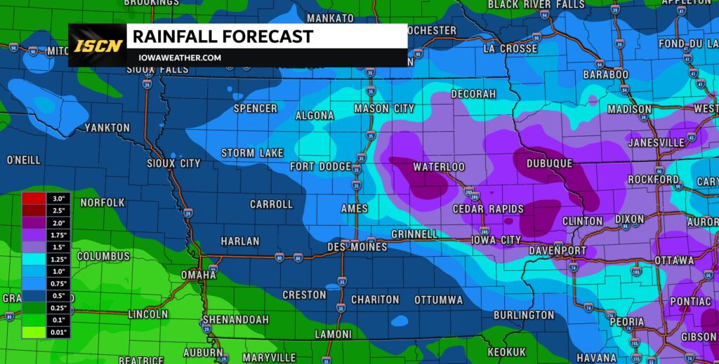
As for rainfall amounts, the Weather Prediction Center (WPC) has the highest amounts across northwest Iowa. The current forecast through 7AM Tuesday, pictured above, shows widespread amounts of 1 to 3 inches across northern Iowa, with less than an inch across the southwest half of Iowa. Placement of the highest rainfall amounts is likely to change each day due to movement of any boundaries from the previous day.
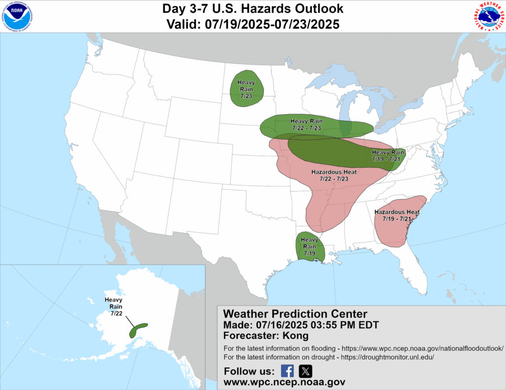
July 21–23: Heat Builds in the South, Rain Continues in the North
By early next week, the weather pattern will shift as a strong upper-level ridge builds over the central U.S., resulting in rising temperatures and dangerous heat.
- The WPC has already issued a Hazardous Heat Outlook for southern Iowa for Monday and Tuesday (July 22–23).
- Meanwhile, the northern half of Iowa remains under the risk for continued heavy rainfall, as storm systems ride the edge of the heat dome.
This setup is commonly referred to as “The Ring of Fire” — a pattern where intense heat and high pressure dominate the southern U.S., while disturbances and storm clusters ride around the northern periphery of the ridge, often bringing frequent thunderstorms and excessive rainfall to the Midwest and northern Plains.
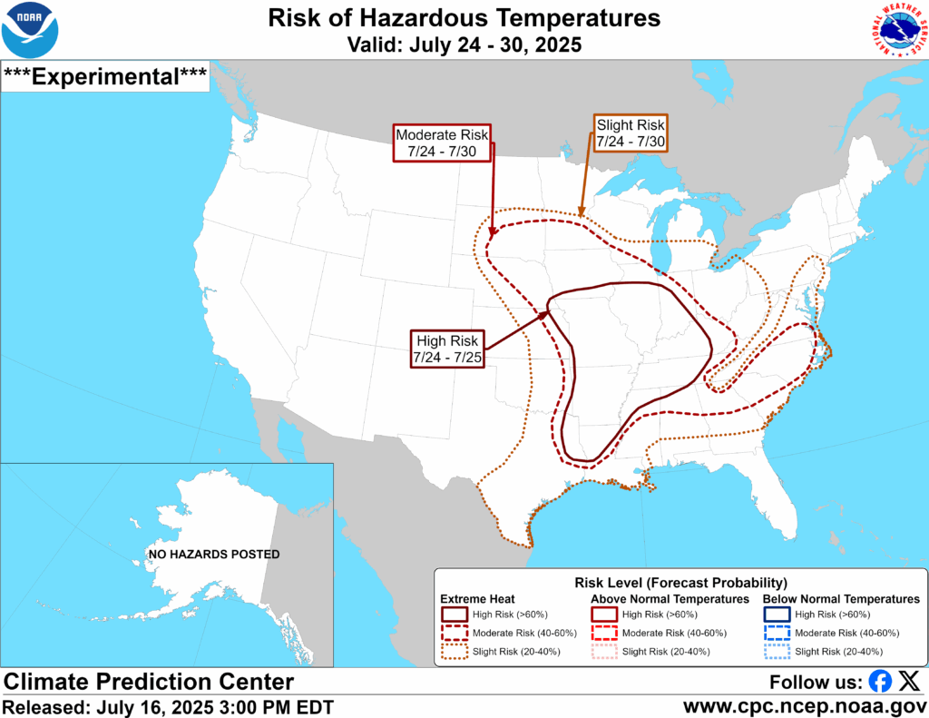
July 24–30: Dangerous Heat Settles In
The Climate Prediction Center (CPC) is highlighting a moderate to high risk of hazardous temperatures across Iowa from July 24–30. During this stretch, temperatures are expected to climb into the 90s, with heat index values well over 100°F thanks to dew points in the upper 60s to 70s — creating very humid and oppressive conditions.
This kind of prolonged heat can become dangerous, especially for vulnerable populations or those working outdoors. Stay hydrated, take breaks in the shade or indoors, and keep an eye on those most at risk.
Summary: What to Watch For
- Friday–Saturday (July 19–20):
- Marginal Risk of Severe Weather (damaging winds)
- Slight to Marginal Risk of Excessive Rainfall
- Possible MCS (storm complex) overnight Friday
- Sunday–Tuesday (July 21–23):
- Rising temperatures in the south
- Heavy rain threat continues in the north due to “Ring of Fire” pattern
- July 24–30:
- Prolonged period of dangerous heat
- Highs in the 90s with tropical humidity
Stay weather aware over the next couple of weeks — from flash flooding to heat-related illness, there will be multiple hazards to monitor. Make sure to follow the Iowa Storm Chasing Network for real-time updates, forecast discussions, and safety information as this active pattern unfolds.