Arctic Air Returns to Finish Out February in the Midwest

So far the winter weather has remained relatively quiet in regards to precipitation during the month of February. However, the temperatures have been on quiet the roller coaster. Over the last couple of weeks, above freezing temperatures have allowed for a large portion of the snow cover to melt away for those who received snow thus far.
Heading into this upcoming weekend, February 18th through the 20th, the temperatures once again are going to be above average. Highs on Friday and Sunday will be in the 40s to 50s, with highs on Saturday in the 20s to 30s.
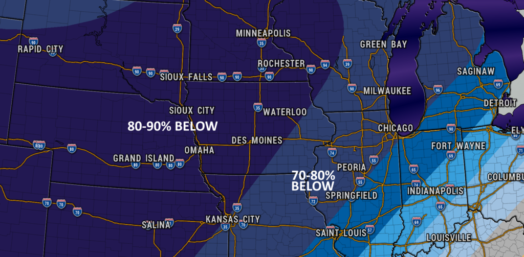
Looking ahead though, arctic air will infiltrate the state by Monday evening. This will bring in much colder air as we head into next week. This is why the Climate Prediction Center has placed the entire state of Iowa in a 70% to 90% probability of below normal temperatures.
What is the Climate Prediction Center?
In the 1980’s the National Weather Service established the Climate Prediction Center (CPC), known at the time as the Climate Analysis Center (CAC). The CPC is best known for its United States climate forecasts based on El Niño and La Niña conditions in the tropical Pacific. The CPC issues climate forecasts valid for weeks and months in advance.
Precipitation Outlook
As for the precipitation for the end of February, the Climate Prediction Center has a near normal probability for precipitation across the state of Iowa. Looking at the weather models, there are a couple chances of precipitation as we head into next week. The first potential is across northern Iowa Monday night into Tuesday. The next system could impact southeast Iowa Thursday afternoon into Friday.
Get Your Latest Iowa Weather Forecast
If you want to know your local weather forecast, be sure to download our free ISCN Weather app on the Android or Apple stores today. Our app provides hour-by-hour forecast, as well as sending you push notifications based on any hazardous weather heading your direction.