Arctic Air to Impact Iowa Ahead of Christmas
Arctic air will filter into the state next week, sending temperatures plummeting. Some of the coldest air will arrive just a few days before Christmas, and this is when high temperatures will likely be in the single digits above and below zero across the state of Iowa. In addition to the bitter cold temperatures, there will also be the threat of a few chances of snow throughout the week as well.
The Forecast
As we head into the weekend, temperatures will range from the upper teens across northern Iowa to the mid to upper 20s across southern Iowa. As we head into Monday, that is when the cold air will really begin to move into the state. Highs on Monday will range from the upper single digits across northwest Iowa to the low 30s across southeast Iowa. Then by Tuesday, high temperatures will struggle to make it above zero across northwest Iowa. While across southeast Iowa, high temperatures will be in the mid to upper teens. Temperatures will continue to drop into Wednesday and Thursday.

Cold Wind Chill Readings
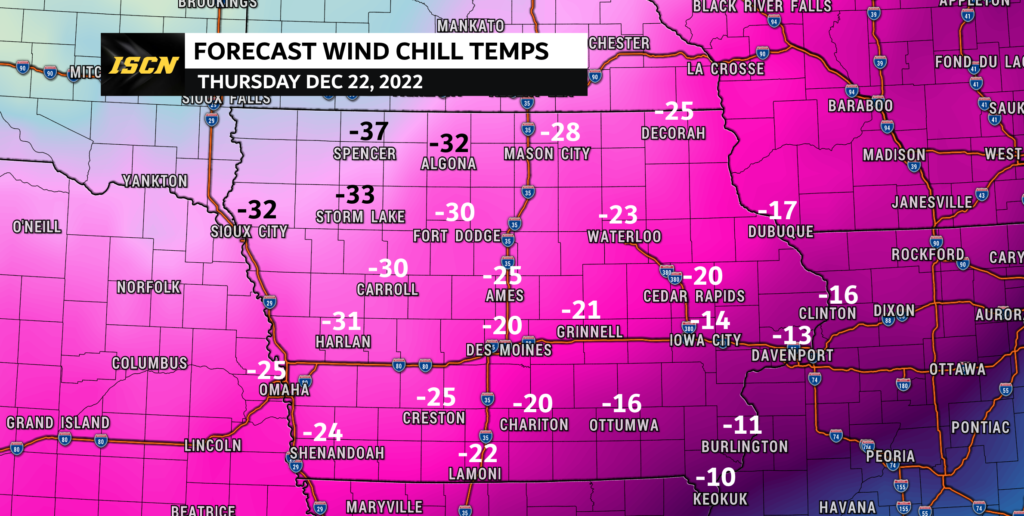
Overnight Tuesday into Wednesday morning, air temperatures will be below zero for most of Iowa. Wind chill readings will range from -10 to -20. As we head into Thursday morning, air temperatures will be even cooler, which will make wind chill readings in the -20 to -40 degree range. These artic temperatures look to hang around through Christmas and even into the first half of the week leading up to the new year.

Will There Be A White Christmas?
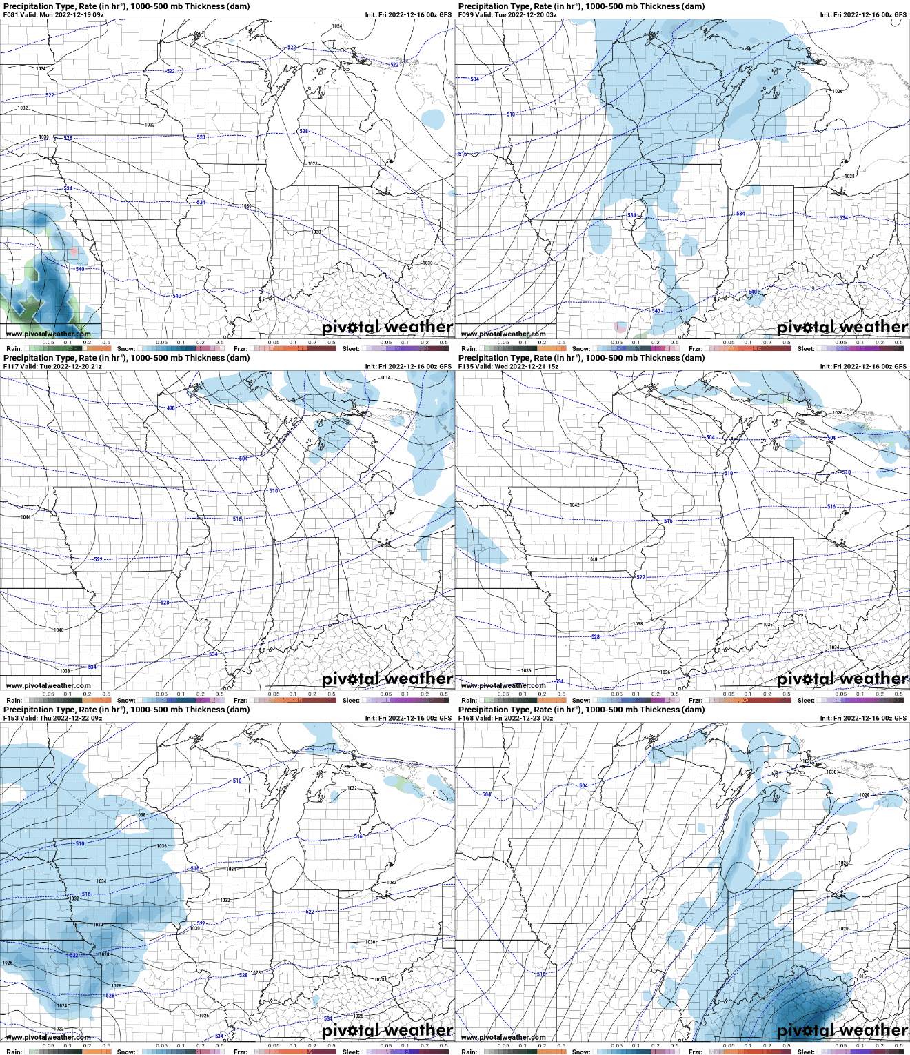
There will be a couple weather systems that will move through the Midwest, that could bring some accumulating snow to Iowa. The first system would be Monday into Tuesday. There are still some model differences around this weather system. The GFS and NAM bring light snowfall amounts to parts of the state, while the EURO stays mainly dry. So we will watch this one throughout the weekend and see which model solution it locks onto.
The next weather system will be around Thursday morning into Friday. Most of the weather models show this system impacting the Midwest, but the track of it is all over the place. The GFS brings it through most of Iowa, while the Euro has it impacting mainly the northeast half of the state. This one will also be watched as we head into next week. Any snow that does fall next week will be very fluffy due to the cold temperatures.
Bottom line is next week will be cold, and possibly snowy. If you are traveling for the holiday, be sure to have our free ISCN Weather app installed for the latest weather forecast updates as holiday travels may be impacted.