Blizzard Conditions Possible Across Northern Iowa Tuesday Night

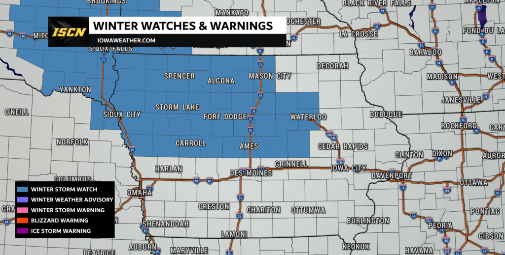
A Winter Storm Watch is now in effect for much of northern Iowa from late Tuesday night through Wednesday morning due to the potential for dangerous blizzard-like conditions—even though no new snow is expected to fall.
Blowing Snow and Near-Whiteout Conditions Possible
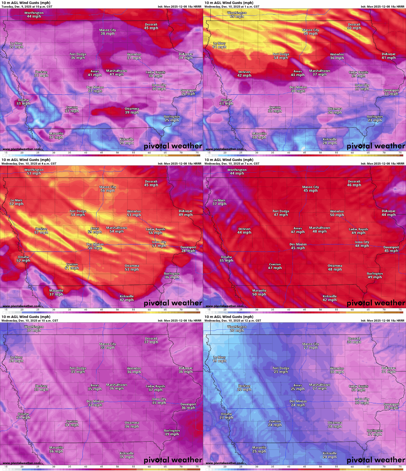
The primary concern is extreme wind, with gusts expected to exceed 50 mph Tuesday night into early Wednesday. With 6 inches or more of snow already on the ground, any initial crust will quickly break down as winds increase. This will lead to significant blowing and drifting snow, reducing visibility to near zero at times.
Even without fresh snowfall, existing snow will be lifted and redistributed, creating conditions similar to a full blizzard.

Travel Could Become Life-Threatening
Roads—especially bridges and overpasses—are expected to become slick and hazardous. Whiteout conditions are possible, making travel treacherous or even nearly impossible in spots. The Wednesday morning commute could be severely impacted.
In addition to visibility issues, strong winds could also bring down tree branches, leading to isolated power disruptions.
Areas Most at Risk
The Winter Storm Watch includes a large portion of northern Iowa, including cities such as:
Mason City, Fort Dodge, Carroll, Ames, Marshalltown, Waterloo, Cedar Falls, Boone, Webster City, Humboldt, Sac City, Estherville, Algona, and many surrounding communities.
What You Should Do Now
- Avoid unnecessary travel late Tuesday night into Wednesday morning
- Have winter survival supplies in your vehicle
- Secure outdoor items that could become airborne in high winds
- Monitor forecast updates closely, as this watch could become a warning
This is a high-impact wind-driven winter event, and conditions could deteriorate rapidly. Even familiar roads may become impossible to navigate in blowing snow.
If you’re new to our site, be sure to follow us on Facebook and on X for real-time updates, forecast discussions, live video coverage, and breaking weather alerts as conditions unfold across Iowa.