Freezing Drizzle to Impact Iowa Wednesday
A round of light freezing rain and drizzle is expected to impact Iowa on Wednesday, February 5, 2025, leading to hazardous travel conditions across much of the state. The National Weather Service has issued a Winter Weather Advisory for several counties as a light glaze of ice is expected to accumulate throughout the day.
Timing and Areas Affected
- Freezing rain and drizzle will develop in southern Iowa Wednesday morning, gradually expanding northward in the afternoon.
- The precipitation is expected to taper off by Wednesday evening.
- The advisory covers a large portion of central, northeast, west-central, south-central, and southeast Iowa, with different start times depending on location.
- South-Central and Southeast Iowa: Advisory in effect from 9 AM to 9 PM CST.
- Southwest Iowa: Advisory in effect from 6 AM to 6 PM CST.
- Central, Northern, and Eastern Iowa: Advisory in effect from Noon to 9 PM CST.

Expected Ice Accumulation
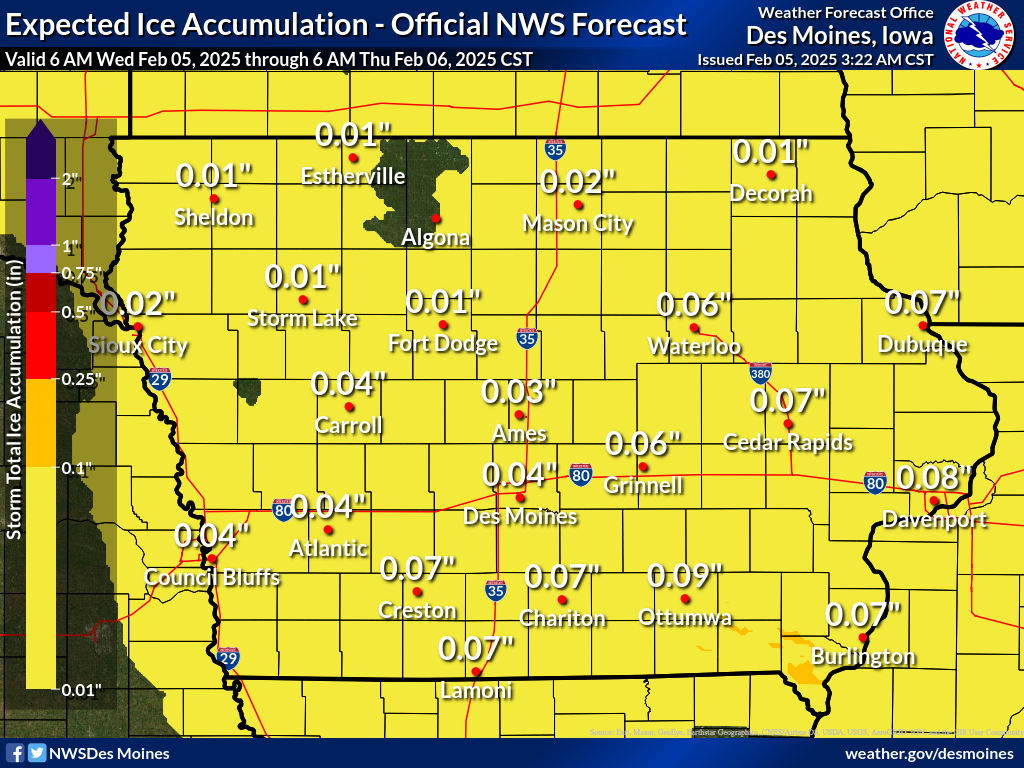
- Ice accumulation is forecasted to be up to one-tenth of an inch.
- While this may seem minimal, even a thin layer of ice can create very slick roadways, sidewalks, and bridges, increasing the risk of accidents and falls.
Travel and Safety Impacts
- Roads and bridges could become slick and hazardous, especially during the evening commute.
- Sidewalks and driveways may also be coated with ice, leading to an increased risk of slips and falls.
- Power outages are not expected to be widespread, but isolated outages could occur where ice accumulates on power lines and trees.
Precautionary Measures
- Slow down and use caution if traveling, especially on untreated roads and overpasses.
- Allow extra time for your morning and evening commutes.
- Monitor local road conditions via the Iowa 511 app or www.511ia.org.
- If you must walk outside, watch your first few steps—icy sidewalks and stairs can be treacherous.
Looking Ahead
Temperatures are expected to remain near freezing through Wednesday night before rising slightly on Thursday. Any remaining ice should melt as temperatures gradually warm, but untreated surfaces may remain slick into Thursday morning.
Stay tuned to the Iowa Storm Chasing Network for the latest weather updates, radar analysis, and real-time reports throughout the event. If you encounter hazardous road conditions, report them to local authorities and stay safe!