Freezing Rain and Snow Monday Across Northwest Iowa

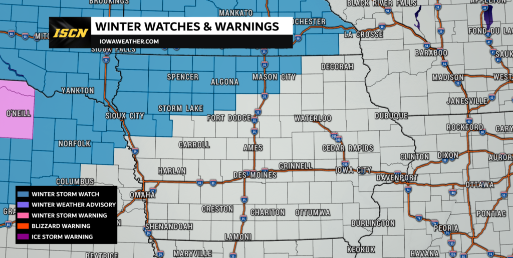
The National Weather Service has issued a winter storm watch from Monday into Tuesday ahead of a storm system that will bring freezing rain and snow. Snow and ice amounts are still in question due to the model uncertainty, so forecast amounts will continue to fluctuate over the next 24 to 36 hours. The current winter storm watch is for total snowfall accumulations ranging from 1 to 3 inches, with ice accumulations ranging from 0.1″ to 0.3″.
Timing of Precipitation

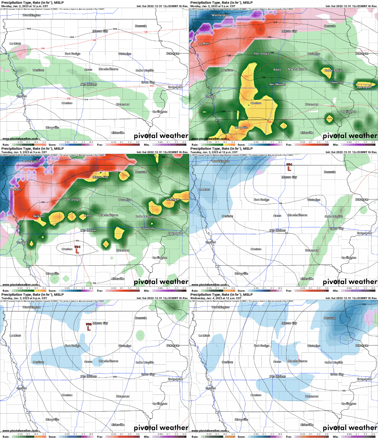
Precipitation will start early Monday morning across northwest Iowa. Initially, precipitation will be in the form of freezing rain and some light snow. This wintry mix will continue throughout the day on Monday and on into the early evening hours of Monday. By early Tuesday, precipitation will transition over to all snow, before coming to an end by Tuesday evening.
Sioux City Timing: A wintry mix of freezing rain and snow will start near sunrise Monday. This will continue through Monday afternoon and early evening. By late Monday into early Tuesday, precipitation will transition over to all snow. Snow will wrap up by the evening commute Tuesday.
Mason City Timing: Freezing rain will begin closer to the noon hour on Monday and will continue through early Tuesday morning. Precipitation will change over to all snow by sunrise Tuesday and will come to an end by late Tuesday.
Estherville Timing: Light snow will be possible early Monday, before sunrise. However, by mid-morning Monday through Monday evening a wintry mix of freezing rain and light snow will be possible. By early Tuesday morning, precipitation will transfer over to all snow and will come to an end by Tuesday evening.
Further to the south across central, southern, and eastern Iowa, rainfall will be likely the entire event. Rainfall amounts will range from 0.25″ to one inch across parts of eastern Iowa. There will even be the potential for some thunder Monday night into Tuesday morning. As the system comes to a close for these areas, some light snow will be possible late Tuesday, but very little to no accumulation will be expected.
Winter Storm Impacts
Impacts from this storm system include power outages and tree damage due to the ice threat. In addition, the Monday evening and Tuesday morning commutes will be impacted. While the track is still evolving, those with travel plans Monday into Tuesday will need to monitor the latest forecast. Be sure to have our free ISCN Weather app installed for the latest watches and warnings sent directly to your mobile device.