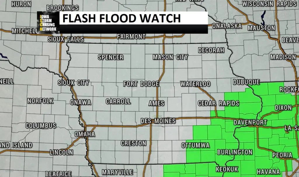
As thunderstorms continue and re-develop this afternoon, evening, and overnight, multiple rounds of moderate to heavy rainfall will be possible over portions of southeast and southern Iowa. This has prompted the Weather Prediction Center (WPC) to place this area at a moderate risk of excessive rainfall.

The potential for 3 to 4 or more inches of rainfall in a relatively short period of time could lead to localized water issues including flash flooding, especially in urban settings. Rainfall rates will be in excess of 1 to 2 inches per hour with these storms. Due to this threat of heavy rain, the National Weather Service (NWS) has issued a flash flood watching across southeast Iowa.
This flash flood watch will be in effect from 4 p.m. Thursday afternoon through Friday morning. Within this watch area, significant ponding may occur, especially in urban settings. Flash flooding will also be possible around small streams and hilly areas. You should monitor later forecasts and be prepared to take action should Flash Flood Warnings be issued.