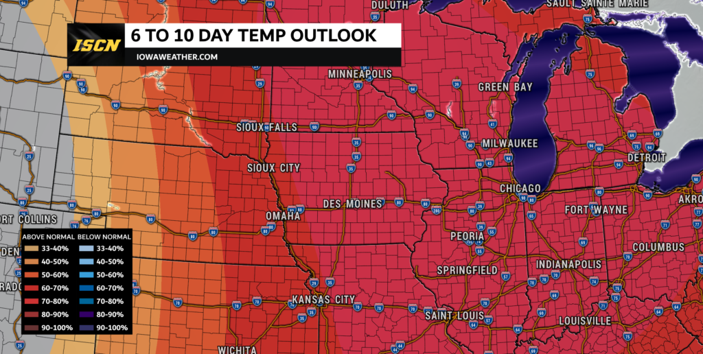
There will be a change in the weather pattern this week. The forecast promises a warm and relatively quiet week ahead, with temperatures soaring into the 40s and 50s, and some areas even flirting with the 60-degree mark by Thursday. However, this meteorological joy ride doesn’t last long, as a pattern transition sets the stage for a return to more seasonal conditions by the weekend.
Midweek Delight:
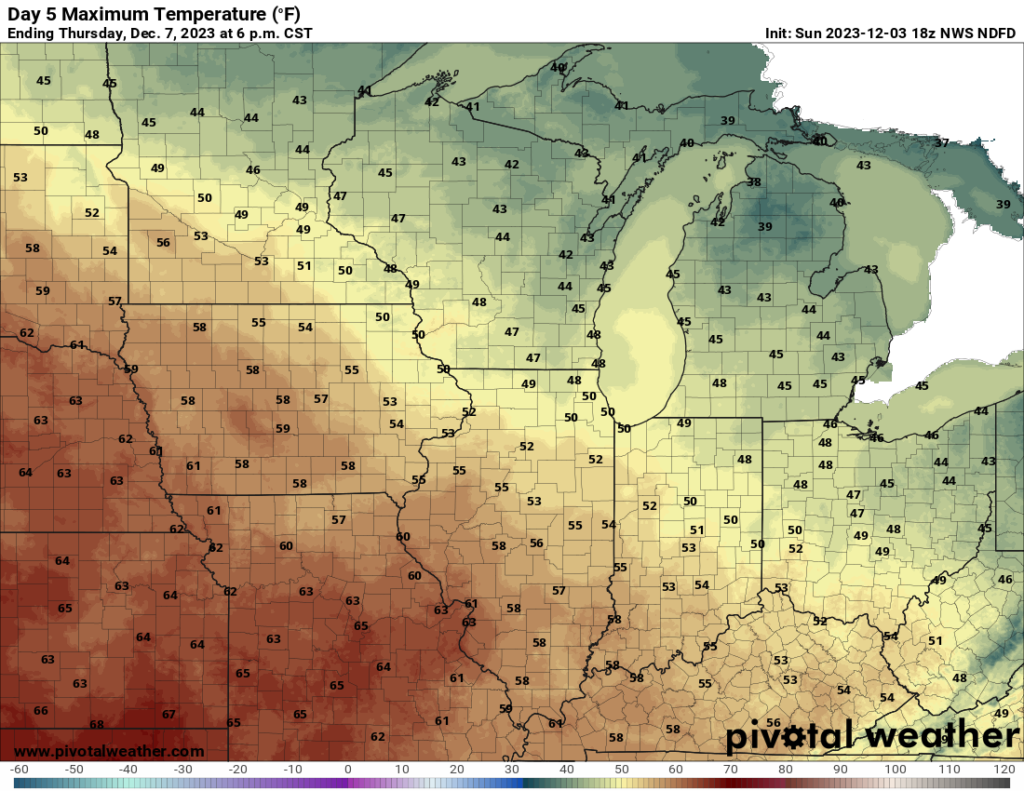
The turning point in the weather comes midweek, as upper-level ridging takes control, ushering in dry conditions and a resurgence of southerly low-level flow on Wednesday and Thursday. This atmospheric shift is set to propel temperatures well into the 50s, and in some lucky locales, even surpassing the 60-degree milestone on Thursday. Excitement builds as daytime highs threaten to approach records, creating an unseasonably warm interlude for Iowa residents.

The following table is forecast highs from the National Weather Service compared to the record highs for December 7th courtesy of the Iowa Environmental Mesonet:
| City | Forecast High | Record High |
| Ames, Iowa | 59°F | 58°F |
| Carroll, Iowa | 59°F | 64°F |
| Cedar Rapids, Iowa | 54°F | 49°F |
| Creston, Iowa | 58°F | 56°F |
| Des Moines, Iowa | 60°F | 62°F |
| Dubuque, Iowa | 50°F | 47°F |
| Fort Dodge, Iowa | 58°F | 59°F |
| Lamoni, Iowa | 58°F | 60°F |
| Mason City, Iowa | 54°F | 44°F |
| Muscatine, Iowa | 55°F | 54°F |
| Oskaloosa, Iowa | 58°F | 57°F |
| Sioux City, Iowa | 60°F | 68°F |
| Waterloo, Iowa | 55°F | 47°F |
Short-Lived Bliss:
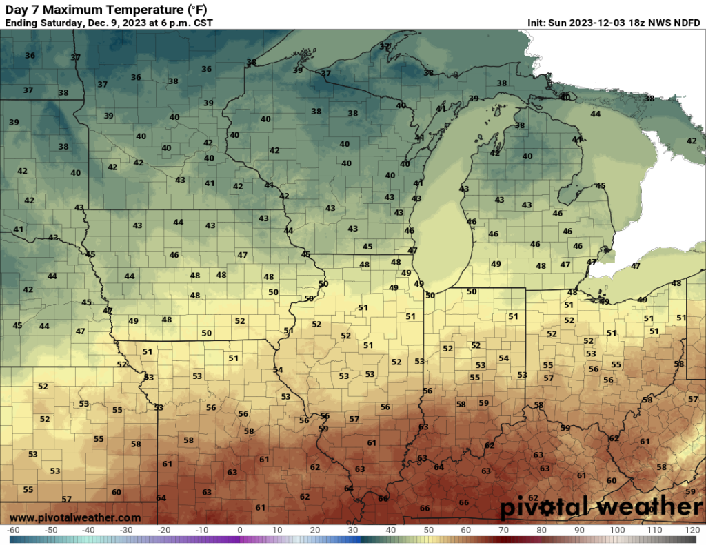
However, the thrill is short-lived, as atmospheric dynamics morph into lower amplitude zonal flow, paving the way for upstream troughing. This will cause the mercury to take a nosedive, settling back into the 40s by the approaching weekend. Enjoy the midweek warmth while it lasts, as it serves as a brief reprieve before the return to more typical early December temperatures.

Forecast Uncertainties:
The upcoming weather scenario isn’t without its uncertainties. Meteorologists are closely monitoring the different deterministic solutions. The 00Z deterministic solutions suggest a faster, drier surface solution, while both the GEFS and EPS models paint a slightly slower and potentially wetter picture. Median Quantitative Precipitation Forecast (QPF) values hint at the possibility of at least some precipitation, adding an element of unpredictability to the latter part of the week.