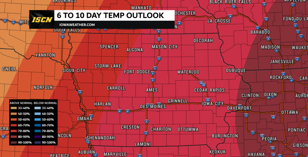
The Climate Prediction Center (CPC) released the latest 6 to 10 day temperature and precipitation outlook on Wednesday. If you’re looking forward to the winter weather, the latest outlook is not for you. In the latest 6 to 10 day temperature outlook, the CPC has a 60 to 80% probability of above normal temperatures across the state.
What does this mean for temperatures in Iowa? Average highs to start out the first week of November are in the 50s across the state. This means highs will likely be 10 to 15 degrees above average for most of the state during this timeframe.

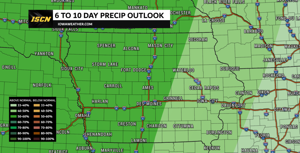
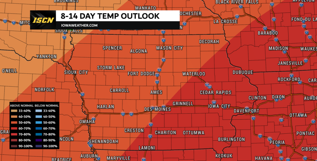
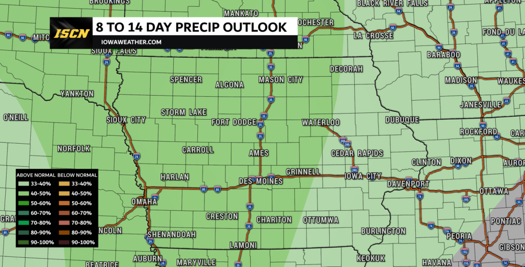
As for precipitation, there is a 40 to 50% probability of above normal precipitation across the eastern half of the state, and a 50 to 60% probability of above normal precipitation across western Iowa. Looking beyond the November 1st through 5th timeframe, temperatures and precipitation chances continue to stay above normal in the November 4th through 10th period.

Temperatures by the middle of November on average are in the 40s to near 50 degrees across the state. This would put temperatures above this range during this timeframe. Precipitation chances also look to be above normal during the November 4th through 10th period as well.

For the latest local weather forecasts, head on over to our weather forecast page. There you will find the current weather conditions, seven day weather forecast, and interactive weather radar. You can also download our free ISCN Weather app to check the weather forecast on-the-go.