Iowa is bracing for a potent spring storm system on Tuesday, April 1st, 2025, with a risk of severe weather including strong winds, large hail, and possibly even isolated tornadoes. The National Weather Service (NWS) and Storm Prediction Center (SPC) have been closely monitoring the evolving setup, which features a strengthening low-pressure system, gusty winds, and increasing instability across the region.
What’s Driving the Storm System?
A low-pressure system is expected to develop over the central High Plains on Tuesday before deepening and tracking northeast into the Midwest. This system will bring a warm front into Iowa, allowing temperatures to rise into the 50s and 60s across the southwest while northern and eastern parts of the state remain cooler in the 40s.
Southerly winds will strengthen ahead of the system, with gusts reaching 30-40 mph during the day. As the storm system moves in Tuesday evening, widespread rainfall and fast-moving thunderstorms are expected to develop, particularly across central and eastern Iowa.
Severe Weather Threat Breakdown
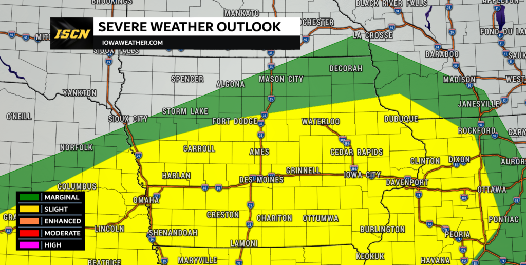
The SPC currently has a 15% severe weather risk over central Iowa, indicating a notable threat for strong storms. Here’s a closer look at the primary hazards:
- Damaging Winds: Wind gusts of 60-70 mph will be possible with the strongest storms, particularly in central and southern Iowa.
- Large Hail: Elevated instability combined with strong wind shear creates a favorable environment for elevated supercells capable of producing large hail Tuesday evening into early Wednesday. Hail stone sizes could range from quarter to golf ball sized.
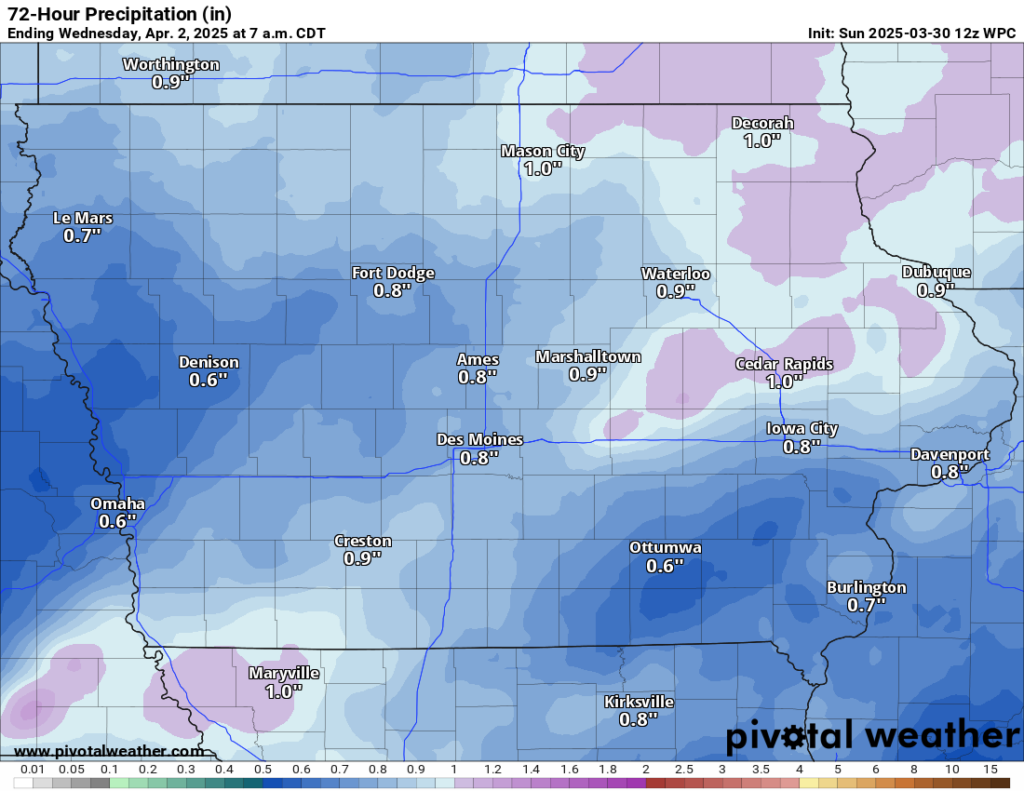
- Heavy Rainfall: Storms will bring widespread rainfall of 0.5 to 1.25 inches, which could lead to localized flooding concerns.

Timing & Impact Areas
- Tuesday Morning: A mix of rain and snow is possible in northern Iowa as a shortwave disturbance moves through.
- Tuesday Afternoon: Winds increase, and temperatures rise in the warm sector. Most of the state remains cloudy with scattered showers.
- Tuesday Evening into Early Wednesday: The main severe threat unfolds as storms develop and race northeast across the state. Central and eastern Iowa will be at the highest risk for severe weather, particularly for hail and strong winds.
Severe Threat on Wednesday in Eastern Iowa
While storms will continue into Wednesday morning, the severe threat will be more limited. The SPC has placed parts of eastern Iowa under a Slight Risk (Level 2 of 5) for severe weather, but the primary threats will shift eastward as the system progresses.
Stay Weather Aware
With the potential for fast-moving storms, it is crucial to stay weather-aware. Stay tuned to the Iowa Storm Chasing Network Facebook page and IowaWeather.com for the latest updates.
For real-time alerts, download the ISCN Weather App, which is free and provides push notifications for severe thunderstorm watches, warnings, and other dangerous storm alerts in your area or any location you set up.
Now is the time to review your severe weather safety plan, ensure you have multiple ways to receive warnings, and be prepared for potentially dangerous conditions Tuesday evening into early Wednesday.