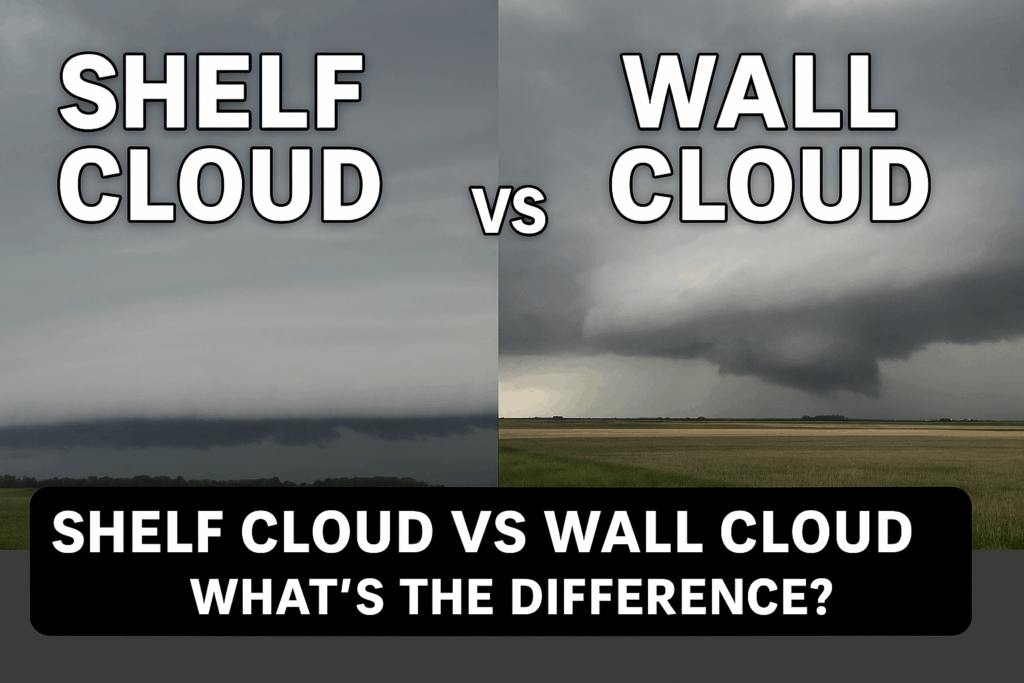
Shelf Cloud vs. Wall Cloud: What is the Difference

Every spring, severe storms bring dramatic skies to Iowa and the Midwest, often captivating or concerning observers. Two of the most commonly confused storm features are shelf clouds and wall clouds. While they may look similar to an untrained eye, they are very different in formation, appearance, and the severe weather they indicate.
Quick Comparison: Shelf Cloud vs Wall Cloud
| Feature | Shelf Cloud | Wall Cloud |
|---|---|---|
| Formation | Outflow: cool air pushes warm air upward | Updraft: warm, moist air rises into storm |
| Position | Leading edge of a thunderstorm | Usually at the rear, rain-free base |
| Appearance | Large, horizontal, wedge-shaped | Localized, lowered, often cylindrical |
| Rotation | Typically does not rotate | May rotate (tornado indicator) |
| Main Threat | Strong winds, heavy rain | Potential tornado development |

What is a Shelf Cloud?
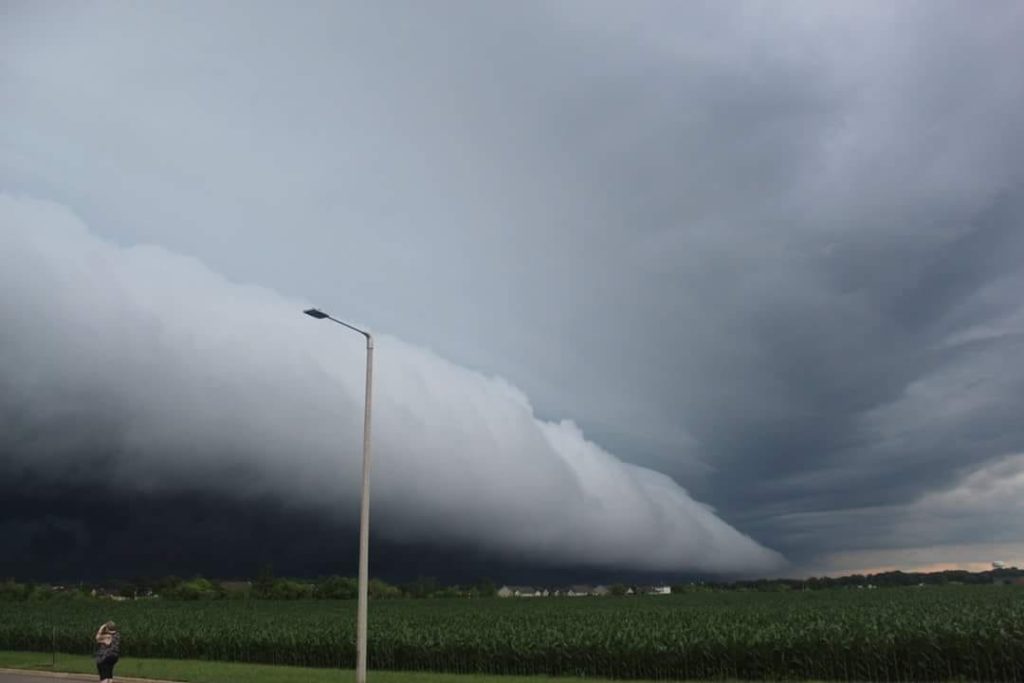
A shelf cloud gets its name from its broad, shelf-like appearance. It is a low, horizontal cloud formation found along the leading edge of a thunderstorm’s outflow. As cold air from the storm’s downdraft surges outward, it forces warm, moist air upward, creating this dramatic, wedge-shaped cloud—quite literally forming a visible “shelf” in the sky.
- Main threat: Strong winds, heavy rain, and sometimes hail.
- Appearance: Wide, layered, and may look like it’s rolling or rotating horizontally. This “shelf” look is what gives the cloud its name.
- Not typically a tornado risk: While shelf clouds can look ominous, they are not precursors to tornadoes.
Shelf clouds are often seen with squall lines or bow echoes, signaling intense winds.

What is a Wall Cloud?
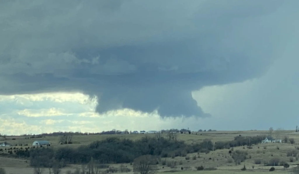
A wall cloud is a localized lowering of the cloud base that forms beneath the updraft of a thunderstorm, usually in the rain-free area of a supercell.
- Main threat: Indicates strong updraft; rotating wall clouds can produce tornadoes.
- Appearance: Circular or cylindrical lowering beneath the main storm base.
- Often rotating: A rotating wall cloud is closely watched by meteorologists and storm spotters.
Not every wall cloud leads to a tornado, but nearly all tornado-producing storms first exhibit a rotating wall cloud.
In Summary
✅ Shelf clouds mark the storm’s outflow and gusty winds.
🚩 Wall clouds mark the storm’s powerful inflow, and if rotating, they signal possible tornado formation.
Knowing the difference helps you better understand the severity of the storm you’re watching.
Frequently Asked Questions
Are shelf clouds dangerous?
Shelf clouds indicate strong, gusty winds and heavy rain. While they rarely produce tornadoes, the winds they signal can cause damage.
Do all wall clouds produce tornadoes?
No. Most wall clouds do not result in tornadoes, but a rotating wall cloud is a key warning sign.
How can you tell a shelf cloud from a wall cloud?
Shelf clouds are large, horizontal, and found on the front edge of storms. Wall clouds are smaller, vertical lowerings under the storm’s base, often toward the back.
What should I do if I see a rotating wall cloud?
Seek shelter immediately. Rotating wall clouds can quickly lead to tornado formation.
Additional Cloud Types Linked to Severe Weather
- Cumulonimbus clouds: Tall thunderstorm clouds with anvil tops.
- Mammatus clouds: Pouch-like features beneath anvils, signaling turbulence.
- Supercells: Rotating thunderstorms often producing wall clouds and tornadoes.
Stay Weather Aware
Always monitor trusted sources like NOAA or your local meteorologists. Download weather apps for real-time alerts, and never ignore watches or warnings.
About the Author
Zach Sharpe is a weather forecaster and owner of the Iowa Storm Chasing Network, with over a decade of storm chasing and forecasting experience across the Midwest.
📸 Photo credits: Adam Walters – Huxley, Iowa.