Slight Risk of Strong to Severe Storms Sunday

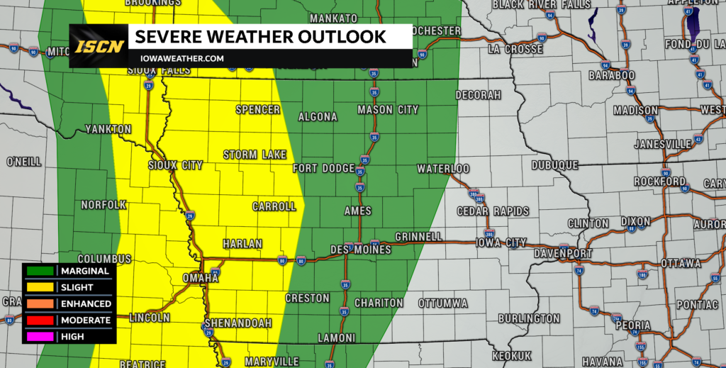
The Storm Prediction Center has issued a slight risk of severe weather Sunday evening across portions of western Iowa, eastern Nebraska, southeast South Dakota, and southwest Minnesota. A cold front will be approaching the state by late Sunday afternoon, and this could develop a few strong to severe thunderstorms.
Timing of the Storms
There still remains a degree of uncertainty in the development of the storms Sunday evening due to a cap on the atmosphere. Some of the models show the cap weakening before sunset, others are waiting until after sunset. One of the things that would help the cap to erode before sunset is afternoon sunshine. However, clouds are expected to filter into the state Sunday and this would limit the surface heating. If the clouds can thin, or do not show up, the sun can heat the surface enough and possible initiate storms before dark. At this current time, thinking is storms will develop around 8pm in western Iowa and will move quickly off to the east, weakening with time.

Severe Weather Threats
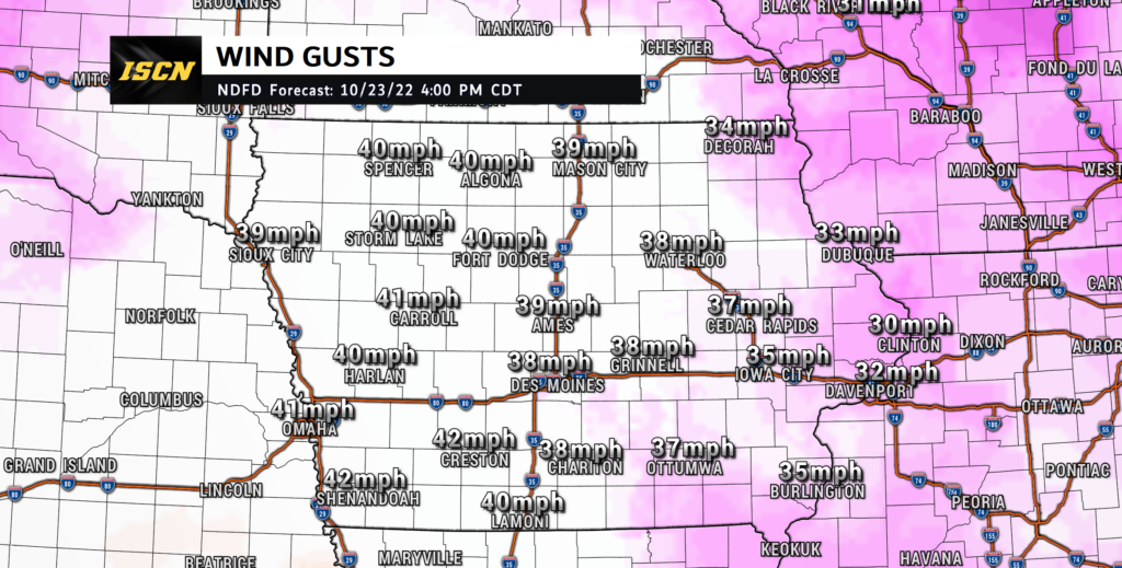
Due to the storms likely developing after dark and being elevated, the primary threats with any storms that do become strong to severe will be damaging wind gusts and large hail. If storms can develop before sunset and become surfaced-based, there is a very low threat for a tornado or two near the Iowa/Nebraska border. In addition to the severe weather threats, strong winds will also be likely Sunday afternoon ahead of the cold front. These wind gusts could approach wind advisory criteria, so it is possible that a wind advisory will need to be issued for portions of Iowa Sunday afternoon.

Forecast Rainfall Amounts For Iowa
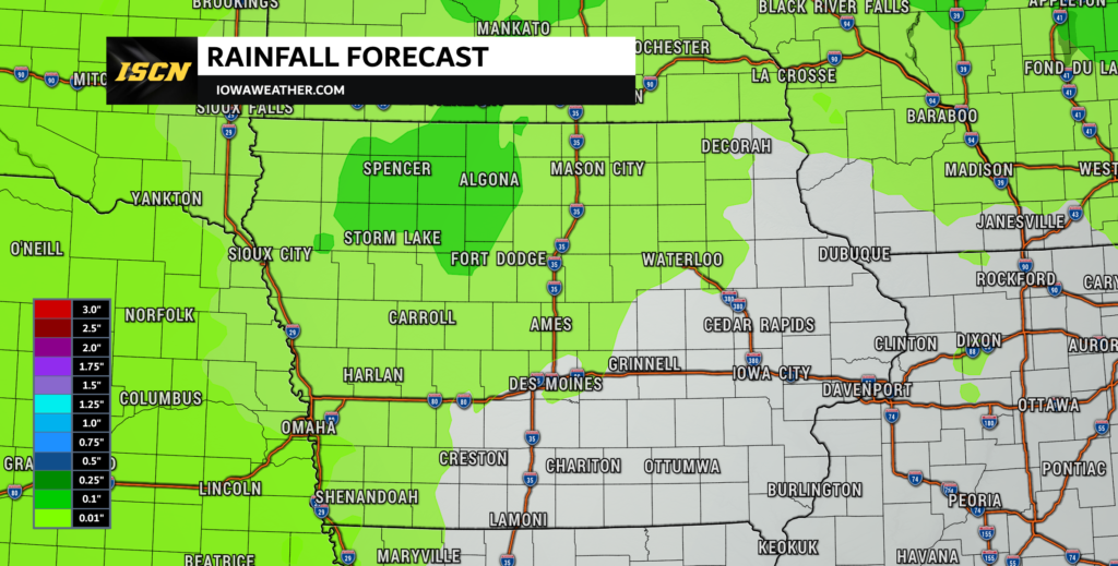
If you were hoping for a good amount of rain to help lessen the drought conditions across the state, unfortunately, there will not be a lot of rain this go around. Rainfall amounts will only range up to a tenth of an inch across portions of Northwest Iowa. (Amounts for Sunday into Monday morning in map above)
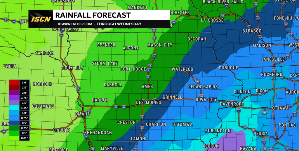
However, as the cold front passes through on Monday, it will bring additional rain to central and eastern Iowa. This will bring a good amount of rain to areas of eastern Iowa as rainfall amounts will range from a half-inch, up to an inch of rainfall. (Total rainfall amounts from Sunday through Wednesday below)

Track the Severe Weather
Be sure to continue to monitor the latest severe weather updates as the forecast will continue to evolve as we go throughout the weekend. Have our ISCN Weather app installed on your mobile device to receive push notifications directly to your device. You can also find us on Facebook, Twitter, and YouTube for the latest forecast updates.