A weather system is set to bring a series of changes in the coming days. This will bring a stretch of rainy and unsettled weather from the middle to the end of the week. Let’s break down what to expect over the next few days.
Tuesday Night into Wednesday: Showers and Thunderstorms
A shortwave trough is heading towards the Rockies, and a low-pressure system will develop over the central High Plains, creating a warm front that stretches across Kansas into Missouri. This warm front will usher in a surge of warm, moist air. This combination of warm, moist air and atmospheric dynamics will lead to the first round of showers and thunderstorms, moving from southern Iowa Wednesday morning to northern Iowa by Wednesday night.

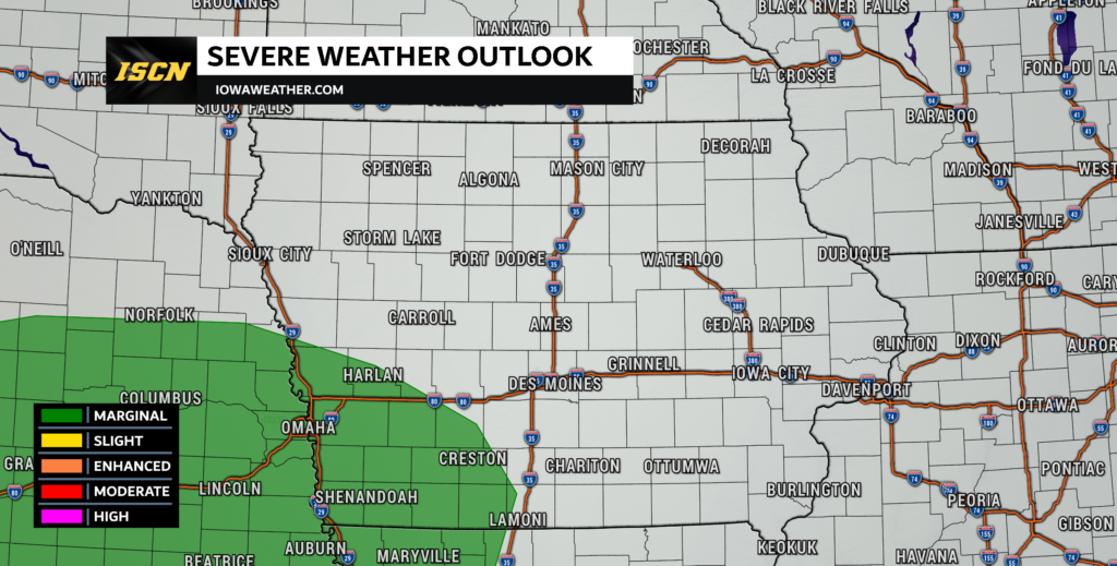
Various weather models agree that this first round will consist mainly of showers and thunderstorms, but the risk of severe weather does exists, especially near the Missouri border in southwest Iowa. This is where the Storm Prediction Center has an area highlighted in a marginal risk of severe weather. Storms will mainly be elevated, so hail will be the primary threat.
Wednesday Night into Friday: Soggy Stretch
Wednesday night into a good part of Friday will bring widespread rain showers and thunderstorms. These will be supported by continued warm air advection (a process where warm air replaces cooler air), increased convergence (the coming together of air masses), and strengthening atmospheric dynamics.
Breezy winds are also expected, with the strongest winds likely on Thursday night into Friday, possibly reaching gusts of around 40 mph in parts of the region. The exact path of the surface low-pressure system will be crucial, as it will determine where the heaviest rain and strongest winds occur.
Uncertain Storm Activity on Thursday
Thursday brings the potential for stronger storms, but uncertainty remains. There’s plenty of wind shear (changes in wind speed and direction with height) and moderately steep mid-level temperature changes. However, the amount of instability, which fuels severe storms, remains uncertain. It’s likely that any storms will be elevated.

Rainfall Totals and Flood Concerns
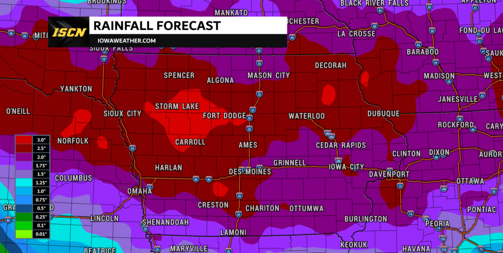
While it’s uncertain where the heaviest rain will fall, it’s clear that significant rainfall will affect nearly all of the state. Various models show widespread totals of 1 to 2 inches, with some areas receiving 3 to 6 inches of rain. The Weather Prediction Center maintains a marginal excessive rainfall outlook for much of Iowa for the period, with a slight risk across portions of northwest Iowa on Thursday. Widespread flooding is unlikely due to the excessively dry conditions across the state leading up to this event.
While the exact details, such as storm intensity and rainfall amounts, may vary, it’s crucial to stay informed about local weather forecasts and be prepared for potentially wet and breezy conditions. This rainfall is much-needed to alleviate drought conditions, but it may disrupt outdoor activities and agriculture temporarily.