The week of February 10th, 2025, is shaping up to be a busy one for winter weather in Iowa. After a relatively quiet stretch, three separate snow chances will bring accumulating snowfall to different parts of the state. Here’s what to expect:
1. Monday – Northwest Iowa
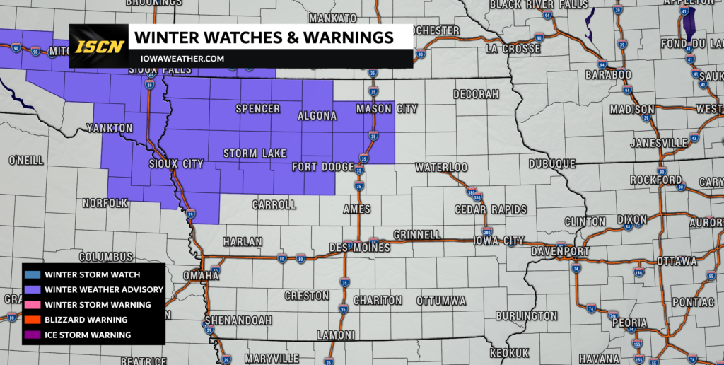
The first system will impact northwest Iowa starting late Monday morning and continuing through the afternoon/early evening. A band of snow will form as the air lifts and colder air moves in at the lower levels of the atmosphere. The conditions in the atmosphere will support the formation of light, fluffy snowflakes, meaning the snow will pile up quickly even with small amounts of moisture in the air. Expect this snow to be easy to shovel but prone to blowing and drifting.
- Expected Snowfall: 2 to 4 inches, with higher totals possible in localized areas.
- Primary Impacted Areas: Northwest Iowa, especially near the Minnesota border.
- Travel Concerns: Reduced visibility and slick roads due to accumulating snow.
- Winter Weather Advisory Issued: A winter weather advisory has been issued for this portion of northwest Iowa from noon Monday to midnight. Snowfall rates could reach up to half an inch per hour for a few hours.

2. Late Tuesday into Wednesday – The Southeast Half of Iowa
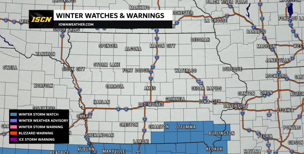
A more significant system arrives Tuesday night, bringing a prolonged period of snowfall across southern and central Iowa. A strong low-pressure system moving through Missouri will generate widespread snow, particularly in southeastern Iowa. This storm has the potential to produce heavier snowfall rates and may meet winter storm warning criteria in some areas.
- Expected Snowfall: 4 to 8 inches possible in southeastern Iowa, with lower amounts farther north due to drier air.
- Primary Impacted Areas: Southeastern and portions of central Iowa.
- Winter Storm Watch Issued: Some areas have a 50-70% chance of reaching 6 inches or more of snow.
- Travel Concerns: While winds will not be overly strong, snowfall rates may briefly reach an inch per hour, leading to hazardous driving conditions.

3. Friday Night into Saturday – Statewide Light Snow Event
The final system of the week arrives late Friday into Saturday. While not as potent as the midweek system, this one could bring widespread light snow across Iowa.
- Expected Snowfall: Generally 1 to 3 inches, with some locally higher amounts possible.
- Primary Impacted Areas: Much of the state, though accumulations will likely remain on the lighter side.
- Timing: Snow develops Friday evening and continues into early Saturday before tapering off.
- Travel Concerns: Light accumulations could create slick spots on roads, especially untreated surfaces.
Bottom Line
Iowa is in for an active winter weather week, with three separate chances for accumulating snow. The highest-impact system looks to be Tuesday night into Wednesday, bringing the potential for heavy snow across southeastern Iowa. Stay tuned to updated forecasts as details continue to evolve, and be prepared for winter travel impacts throughout the week.
Stay safe and warm, and check back for further updates on these upcoming snow events!