What is a Microburst?

When we think of dangerous weather, tornadoes and hurricanes often come to mind. But there’s another weather event that can be just as destructive—yet less understood: the microburst.
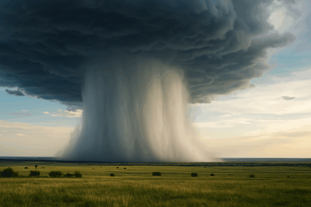
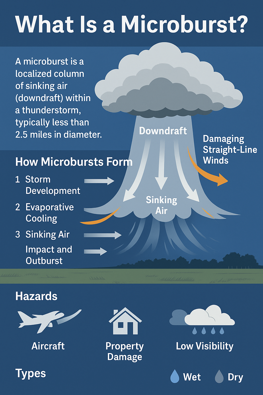
A microburst is a powerful, localized column of sinking air (also known as a downdraft) that forms within a thunderstorm. Although small in size—typically less than 2.5 miles in diameter—microbursts can produce damaging straight-line winds that exceed 100 mph, with impacts often mistaken for tornadoes.

How Do Microbursts Form?
Microbursts develop quickly and can cause widespread damage in just a few minutes. Here’s a step-by-step look at how they form:
1. Storm Development
Thunderstorms with strong updrafts carry rain, hail, and moisture high into the cloud. The atmosphere is often unstable, creating the right setup for downdrafts to develop.
2. Evaporative Cooling
Dry air mixes into the storm. As rain or hail falls through this dry layer, it evaporates or melts, causing the surrounding air to cool rapidly.
3. Sinking Air
This cooler air becomes denser and heavier, causing it to rapidly sink toward the ground—this is the core of the microburst.
4. Surface Impact and Outflow
When the downdraft hits the ground, it spreads outward in all directions, creating damaging winds that move horizontally across the surface—these are known as straight-line winds.
Types of Microbursts
There are two primary types of microbursts:
- Wet Microburst: Accompanied by heavy rain and sometimes hail. These are more common in humid environments.
- Dry Microburst: Occurs when rain evaporates before reaching the ground, resulting in high winds with little or no surface moisture. These are more common in drier regions.
Why Are Microbursts Dangerous?
Despite their small size and short lifespan, microbursts are extremely dangerous and can impact both aviation and populated areas.
Aviation Risks
Microbursts are especially hazardous during takeoff and landing, when aircraft are most vulnerable. Sudden changes in wind speed and direction (wind shear) can lead to loss of lift and control.
Property and Infrastructure Damage
Microbursts can cause damage similar to that of an EF-1 or EF-2 tornado, flattening trees, tearing roofs off buildings, and toppling power lines.
Low Visibility
In the case of wet microbursts, torrential rain can drastically reduce visibility, making it difficult to see or escape the danger in time.
How Are Microbursts Different from Tornadoes?
While both phenomena can cause destruction, they differ in several key ways:
| Feature | Microburst | Tornado |
|---|---|---|
| Wind Direction | Straight-line (outward from impact zone) | Rotating, circular motion |
| Damage Pattern | Linear or fan-shaped | Circular or chaotic |
| Rotation | No rotation | Rotating vortex |
| Duration | Typically 5–15 minutes | Can last from minutes to over an hour |
| Size | Usually < 2.5 miles wide | Can vary from yards to miles wide |
Because the damage from a microburst spreads out in a straight line, it often leads to confusion with tornado damage, especially when no funnel cloud is observed.
How Are Microbursts Detected?
Weather Radar
Meteorologists use Doppler radar to identify wind patterns that show air rapidly sinking and then diverging near the ground. These patterns can indicate the presence of a microburst or other damaging downdrafts.
Forecasting Challenges
Microbursts are difficult to predict because they can form suddenly and last only a few minutes. Forecasting focuses on identifying favorable conditions such as high instability and dry air aloft.
Can You Prepare for a Microburst?
Because microbursts happen so quickly, the best defense is situational awareness during severe thunderstorms. Here are a few safety tips:
- Always monitor weather alerts during storm season.
- Seek shelter indoors when a severe thunderstorm warning is issued.
- Avoid outdoor activities during high-risk conditions (e.g., intense heat and approaching storms).
- Pilots should stay updated with real-time wind shear alerts and radar data, especially near airports.
Final Thoughts
Microbursts may not receive as much attention as tornadoes, but they’re a significant weather hazard capable of causing serious damage in a short period of time. Understanding how microbursts form, how they differ from tornadoes, and how to stay safe can help you better navigate severe weather events.
For more educational content on extreme weather, storm safety, and atmospheric science, explore our other articles at IowaWeather.com.
Frequently Asked Questions (FAQs)
Q: How long do microbursts last?
A: Typically between 5 and 15 minutes, but the winds can cause near-instantaneous damage upon impact.
Q: Can a microburst be stronger than a tornado?
A: Yes, in some cases, microburst winds can exceed 100 mph, matching the wind speeds of an EF-1 or even EF-2 tornado.
Q: Can microbursts be seen on radar?
A: Yes, Doppler radar can detect wind divergence near the ground, which is a key sign of a microburst.
Q: Are microbursts common?
A: They are less common than general thunderstorms but are not rare, especially in regions prone to convective storms and strong instability.