What is a Mesoscale Convective System (MCS)?

A Mesoscale Convective System (MCS) is a large, organized cluster of thunderstorms that works together as a single, larger weather system. Unlike isolated thunderstorms that might pop up and fade away quickly, an MCS can cover vast areas and last for many hours, sometimes overnight.
These systems are a major driver of warm-season rainfall across much of the world and can also be responsible for significant severe weather outbreaks.
How big is an MCS?
By definition, an MCS spans at least 100 kilometers (about 62 miles) in one direction. They are larger than individual thunderstorms but smaller than large-scale (synoptic) weather systems like extratropical cyclones.
Their shape can vary. Some MCSs appear as long lines, while others take on more circular or oval forms.
How long do MCSs last?
MCSs typically persist for several hours, often surviving well into the night. Some may last 8-12 hours or longer, especially if they tap into sustained moisture and instability in the atmosphere.
How do Mesoscale Convective Systems form?
MCSs usually develop in areas where:
- Warm, moist air near the surface meets cooler, drier air aloft.
- Weather fronts or low-level jets enhance lift.
- Converging winds force air upward.
They are common along warm fronts, stationary fronts, and can also form along outflow boundaries from other storms. In tropical regions, MCSs may develop along easterly waves or monsoon circulations.
Types of Mesoscale Convective Systems
An MCS isn’t just one type of storm. It’s an umbrella term for several organized thunderstorm systems, including:
- Squall lines: Long lines of thunderstorms that can stretch for hundreds of miles, often producing damaging winds.
- Mesoscale Convective Complexes (MCCs): Very large, roughly circular MCSs that meet specific criteria for size and duration.
- Bow echoes: Portions of a line of storms that bow outward due to strong winds pushing ahead of the main line.
- Derechos: A particularly intense, long-lived wind event associated with a fast-moving MCS.
What hazards can an MCS produce?
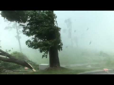
Because of their size and organization, MCSs can bring a variety of severe weather hazards, such as:
- Damaging straight-line winds (sometimes widespread, as in a derecho)
- Torrential rainfall and flash flooding
- Large hail
- Frequent lightning
- Occasionally, tornadoes
What do clouds look like with an MCS?
MCSs often produce dramatic cloud formations. A common feature is a shelf cloud — a low, horizontal, wedge-shaped cloud that forms along the leading edge of the storm’s outflow. This is caused by cooler air from the downdraft lifting warm, moist air ahead of the system.
You might also see towering cumulonimbus clouds reaching high into the atmosphere, along with dense, dark skies and frequent lightning.
Why are MCSs important to understand?
MCSs play a critical role in redistributing heat and moisture in the atmosphere and are responsible for a large portion of summertime rainfall, especially across the central United States. Understanding how they develop and move is essential for improving severe weather forecasts and preparing for potential hazards.
A Mesoscale Convective System (MCS) is a powerful, organized collection of thunderstorms that spans over 100 km (62 miles), lasts several hours, and can produce everything from heavy rain and flash floods to damaging winds and hail. Examples include squall lines, MCCs, and derechos. Whether you’re a weather enthusiast or simply trying to understand that overnight thunderstorm that seemed to last forever, knowing about MCSs helps put these impressive weather systems into perspective.