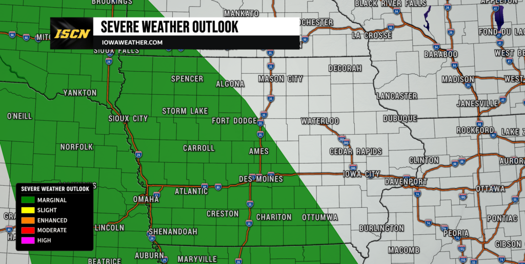
After a stormy start to the weekend for some areas, Iowa will remain under a low-end threat for severe weather through Monday. While widespread severe weather is not expected, a few stronger storms could develop both Sunday and Monday, especially across portions of southern and western Iowa.
Sunday: Conditional Severe Weather Threat
Thunderstorms are expected to move into western Iowa overnight Saturday night into early Sunday morning as a weakening complex of storms tracks eastward across the state. While a few gusty winds are possible in far western Iowa overnight, the primary concern with these storms may be locally heavy rainfall, especially across southern Iowa.
Rainfall totals of 1 to 2 inches are possible in some areas, with isolated higher amounts where storms repeatedly move over the same locations. The Weather Prediction Center continues to highlight portions of southern Iowa in a Marginal Risk for excessive rainfall and localized flash flooding.
Once the overnight storms move out, attention turns to the potential for redevelopment Sunday afternoon and evening.
The Storm Prediction Center maintains a Marginal Risk (Level 1 of 5) for severe weather across much of western and southern Iowa. However, confidence in storm development remains relatively low. Forecast models indicate a warm, humid, and unstable atmosphere will be in place, but a layer of warm, dry air aloft may prevent storms from developing.
If storms are able to form, a few could become strong to severe with:
- Large hail
- Damaging wind gusts
- Locally heavy rainfall
The greatest chance for any severe weather appears to be across southwest and west-central Iowa, though much of the state should remain dry for a majority of the day.
Temperatures Sunday afternoon will climb into the upper 70s and 80s with muggy conditions continuing statewide.
Monday: Lower Severe Risk but Storm Chances Remain
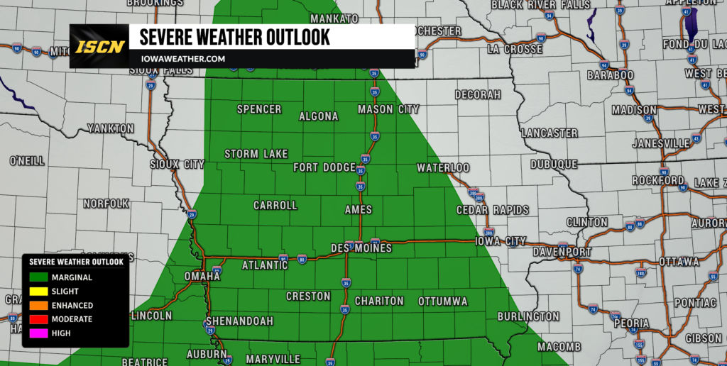
The overall severe weather threat appears lower across Iowa on Monday.
The Storm Prediction Center’s primary severe weather outlook focuses farther south across the Mississippi and Tennessee Valleys and west into portions of Kansas and eastern Colorado. Iowa remains north of the more favorable severe weather corridors.
However, isolated showers and thunderstorms cannot be ruled out, particularly during the afternoon and evening hours. Forecast guidance suggests upper-level ridging will begin building into the region, limiting storm coverage and keeping most locations dry.
Any storms that do develop could produce brief gusty winds and lightning, but widespread severe weather is not anticipated at this time.
Looking Ahead
Warm and humid conditions will continue through much of the upcoming week, with highs generally in the 80s. Additional chances for showers and thunderstorms are expected by the middle of the week as moisture gradually returns to the region.
For now, the greatest concern remains the potential for isolated strong storms and locally heavy rainfall on Sunday, particularly across southern and western Iowa. Be sure to monitor the forecast for updates, especially if you have outdoor plans this weekend.
Stay ahead of changing weather conditions by downloading the ISCN Weather app and checking IowaWeather.com throughout the weekend for the latest forecast updates.