After several days of dry weather across much of Iowa, rain chances are set to increase this weekend as a more active weather pattern develops across the Midwest.
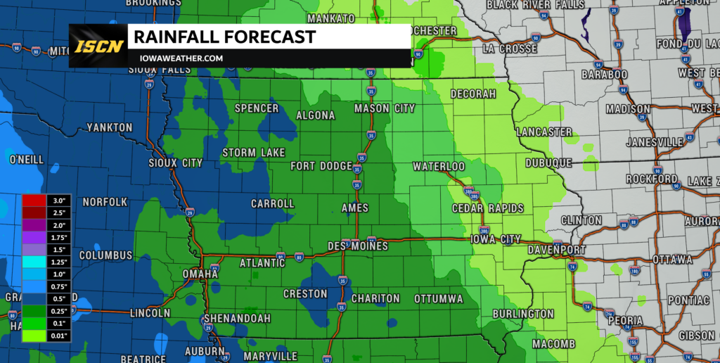
Clouds will continue to increase today, with most of Iowa remaining dry through the daylight hours. However, showers are expected to begin moving into western Iowa tonight before gradually spreading eastward into parts of central Iowa overnight and Saturday morning.
While rain will be possible at times on Saturday, it is important to note that this will not be an all-day washout. Instead, expect a mix of scattered showers, a few thunderstorms, and plenty of dry periods throughout the day. Many communities may spend more time dry than wet, although brief downpours could occur where storms develop.
Some locations could receive locally heavier rainfall amounts, with isolated areas potentially picking up over an inch of rain. However, rainfall totals will vary significantly from one location to another, with some communities seeing much less.
Sunday Brings More Showers and Storms
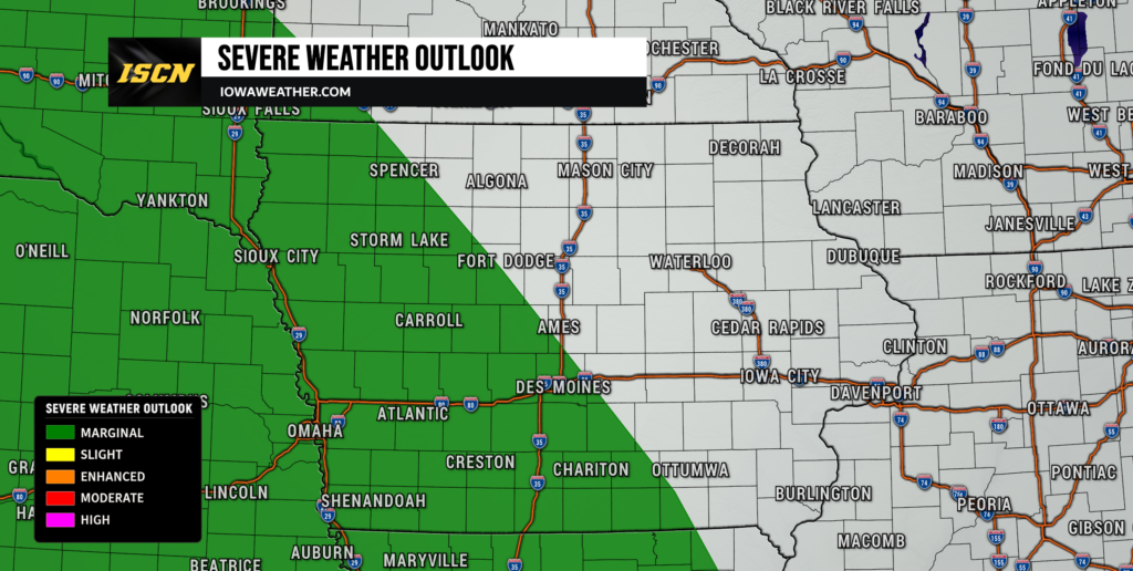
The unsettled weather pattern will continue into Sunday as additional showers and thunderstorms develop across parts of the state.
The Storm Prediction Center has highlighted portions of western Iowa in a Marginal Risk (Level 1 of 5) for severe weather Sunday afternoon and evening. A Marginal Risk means isolated severe storms are possible, but widespread severe weather is not expected.
Warm and humid air will return to the region Sunday, providing enough instability for a few thunderstorms to become strong. If severe storms develop, the primary threats would be damaging wind gusts and hail. However, storm coverage is expected to remain isolated, and many locations may not experience any severe weather at all.
Much like Saturday, Sunday will feature a combination of dry periods and scattered storm chances rather than continuous rainfall.
Looking Ahead
The active weather pattern developing this weekend is expected to continue into next week. Temperatures will climb back into the 80s across much of Iowa, while periodic chances for showers and thunderstorms remain in the forecast.
At this time, widespread severe weather is not expected, but the combination of warm temperatures, increasing humidity, and several weather disturbances moving through the Midwest will create opportunities for scattered storms on multiple days. As is often the case this time of year, some communities could receive beneficial rainfall while others see little to no precipitation.
Forecast details will likely change as we move through the weekend and into next week, especially regarding rainfall amounts and any stronger thunderstorm potential. For the latest Iowa weather forecasts, radar, alerts, and severe weather coverage, download the ISCN Weather app and follow ISCN on Facebook. We’ll continue to provide updated forecast information, weather analysis, and breaking weather updates right here on IowaWeather.com as new data becomes available.