After several rounds of rain across Iowa, Thursday will bring a break from the wet weather—but it won’t be completely uneventful. Drivers should prepare for areas of dense fog early in the morning, followed by hazy skies from elevated wildfire smoke during the afternoon.
Dense fog could impact the Thursday morning commute
With light winds, clearing skies, and saturated ground from recent heavy rainfall, fog is expected to develop overnight across much of the state. The greatest chance for dense fog will be across southern, central, and eastern Iowa, especially where 3 to 5 inches of rain fell over the past 24 hours.
Visibility may drop below a quarter mile in some locations around sunrise, creating hazardous travel conditions for the morning commute. Motorists should be prepared for rapidly changing visibility and allow extra travel time. A Dense Fog Advisory may be issued overnight if confidence continues to increase.
Wildfire smoke returns Thursday afternoon
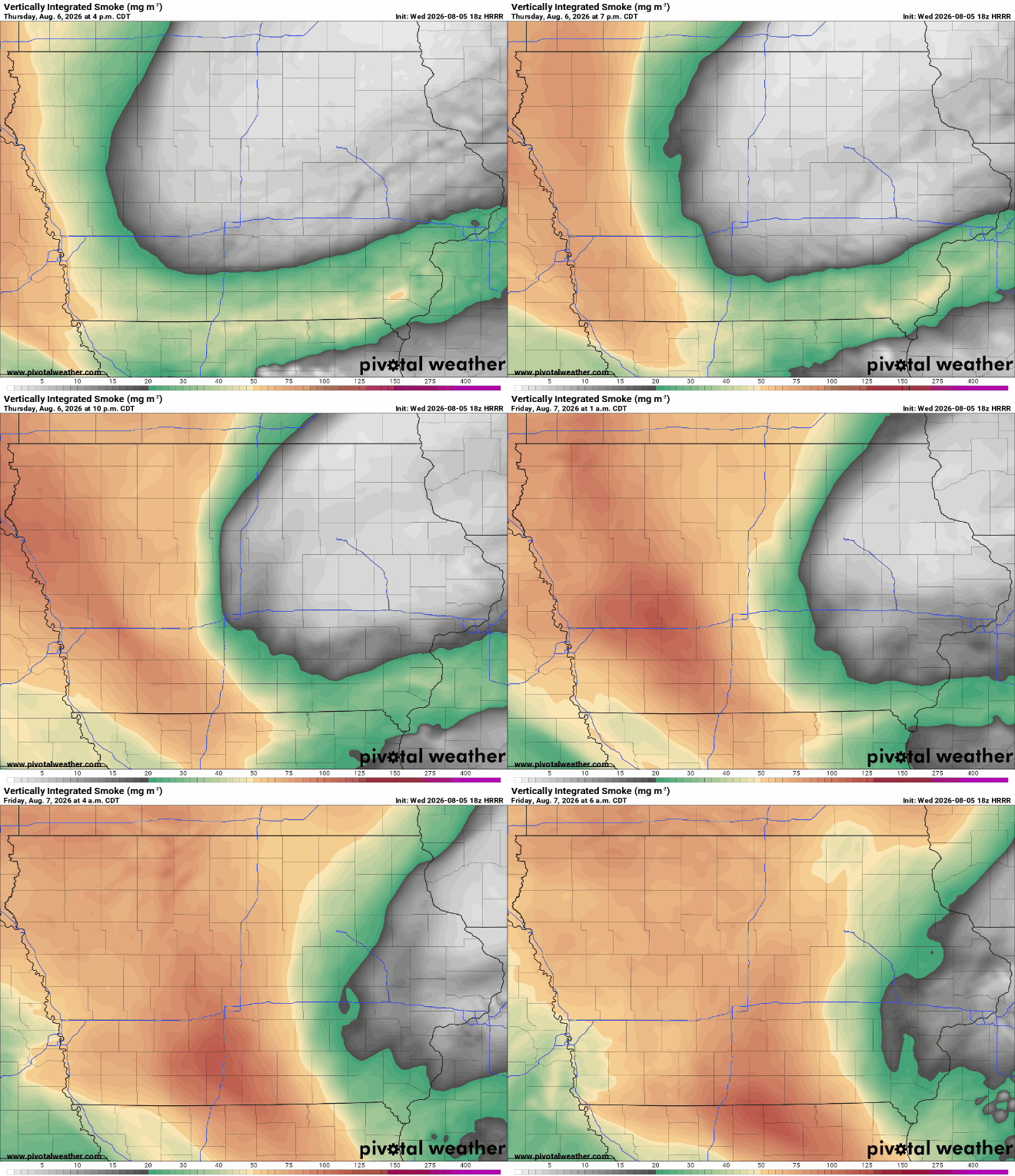
Once the fog burns off by mid-morning, Iowa will enjoy a dry day with highs near 80 degrees. However, another plume of wildfire smoke from Canada will spread across the Upper Midwest.
Most of the smoke is expected to remain high in the atmosphere, creating a hazy or milky appearance to the sky rather than significantly affecting air quality at the surface. While widespread air quality concerns are not anticipated at this time, the smoke may lead to less vibrant blue skies and more colorful sunrises and sunsets.
A quiet day before storms return
Thursday’s dry weather will be short-lived. An active weather pattern returns Friday and Saturday with additional rounds of thunderstorms, including the potential for some severe weather. More opportunities for rain and storms are expected into next week as Iowa remains in a northwest flow pattern.
For now, plan for a foggy start, a hazy finish, and enjoy the brief break from the rain before storm chances increase again.