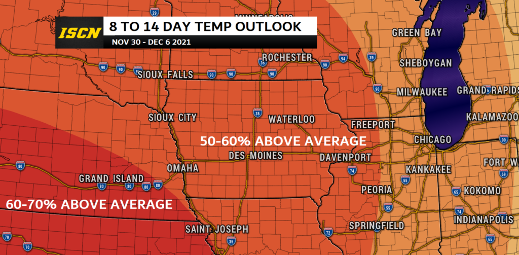
If you were hoping for a good winter storm sometime soon, we have bad news for you. Based on the latest 8 to 14-day temperature outlook issued by the Climate Prediction Center, temperatures from the last week in November through the first week in December are expected to be above average for much of the entire country.

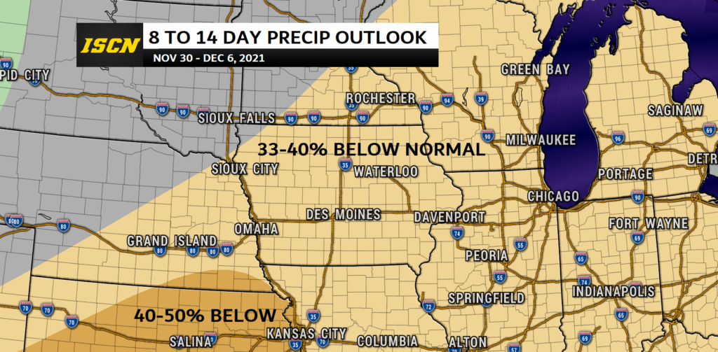
As for precipitation, there isn’t a lot of good news there either. The latest outlook has below average levels of precipitation from the southwestern United States, through the Midwest, and for much of the eastern half of the United States.

What does this mean for Iowa?
Looking at the latest weather models, temperatures will likely be in the 40s and 50s during this timeframe. Temperatures will begin to shift as a weather pattern change appears to occur around the 6th of December. As for precipitation much of this period will be dry. So if you were hoping for any snow, you will likely be waiting until after the 6th of December. Of course, the weather is always changing so be sure to stay updated with the latest forecast. Download our free ISCN Weather app or visit our forecast page for your city.
What is the 8 to 14-day temperature and precipitation outlook?
The 8-14 day Outlook gives the confidence that a forecaster has, given as a probability, that the observed temperature, averaged over upcoming days 8, 9, 10, 11, 12, 13, and 14 will be in the range of one of three possible categories below (B), normal (N), or above (A).