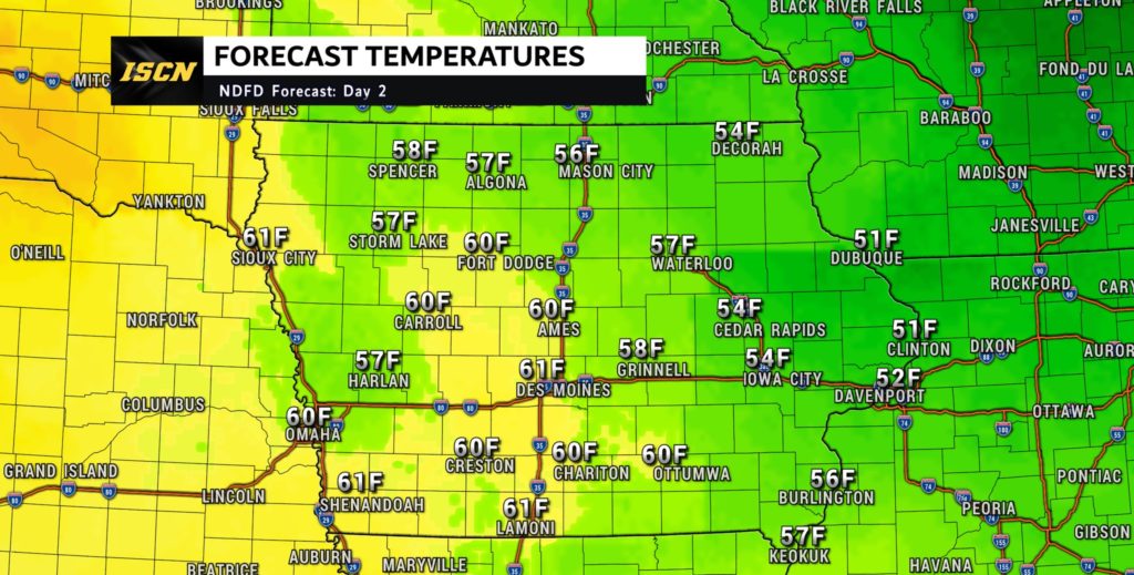
As we dive into the second half of the work week, get ready for a weather rollercoaster that will take us from unseasonably warm highs with near record breaking high temperatures, to the possibility of some wintry precipitation. Let’s break down the details.

Thursday: Soaking in the Warmth
A ridge of high pressure is set to dominate the upper atmosphere, paving the way for unseasonably warm temperatures. Highs are expected to reach the 50s, and some lucky folks might even experience temperatures in the 60s. This surge in warmth is a whopping 20 degrees above normal for this time of year, making Thursday a perfect day to enjoy the outdoors.
Friday: A Cool-down with Clouds
Hold onto your hats as the ridge moves eastward, allowing a shortwave trough to make its presence known. This will usher in a cold front that pushes through the state on Friday. Brace yourselves for a slight cooldown, with highs dropping several degrees from Thursday’s peak. However, don’t let the term “cooldown” fool you; temperatures will still be quite mild for December.
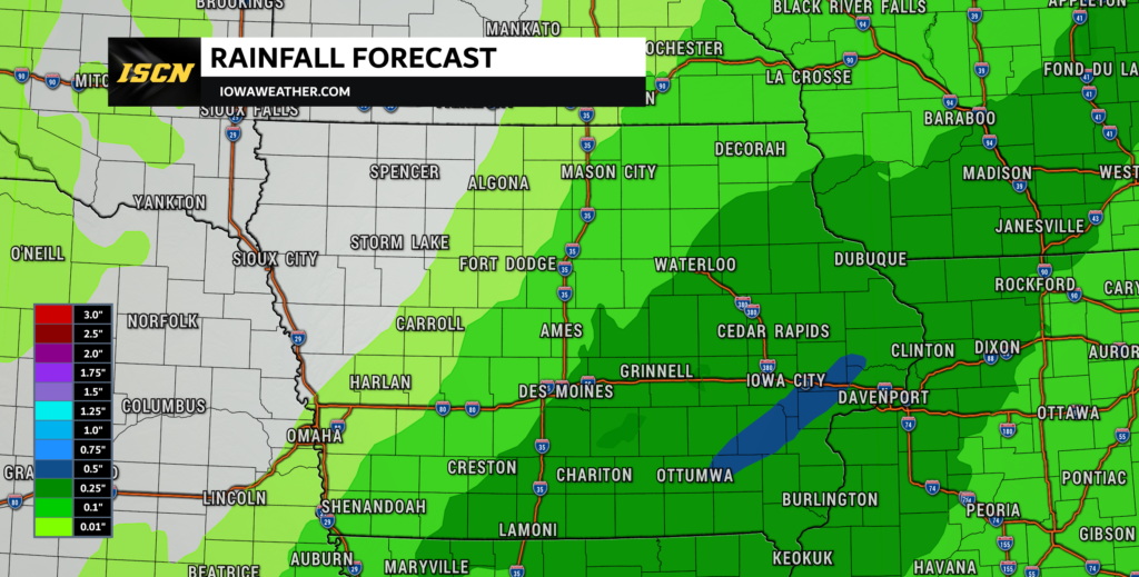
As the shortwave trough makes its journey across the state, we’ll also see an increase in cloud cover. Keep an eye on the skies as we head into Friday night, especially if you’re in southeastern Iowa, where the chance of precipitation is up to a notable 70 to 80%.

Friday Night: Showers and a Hint of Thunder
The weather drama continues into Friday night, with the trough moving over the western US and digging into the southern Plains. While the energy isn’t phasing as well as initially anticipated, there’s still a consensus on precipitation hitting the state, particularly in the southeastern regions.
The chances of rain are high, with a 70 to 80% likelihood during Friday night. Temperatures should support rain for the majority of the event. If you’re in the southeastern forecast area, don’t be surprised if you hear a few rumbles of thunder, adding an extra layer of excitement to the evening.
Saturday Morning: A Brief Wintry Mix?
As the atmosphere cools, there’s a slight chance of a changeover to light snow as the precipitation winds down on Saturday morning. However, the forecast indicates that this won’t be a major snow event, with an 80 to 90% chance that snowfall won’t exceed an inch.
In summary, get ready for a weather rollercoaster this weekend, Iowa. Enjoy the unseasonably warm highs on Thursday, brace for a cooldown with showers and maybe a thunderstorm on Friday, and be on the lookout for a brief wintry mix as we head into Saturday morning. Stay tuned for updates, and as always, stay weather-aware!
Check out your local weather forecast on our weather forecast page.