A significant mid-week pattern change is set to unfold, bringing about warmer temperatures, potential record highs and overnight lows, and even a chance of thunderstorms. Let’s break down the forecast in simpler terms to understand what’s in store this week.
Temperature Surge
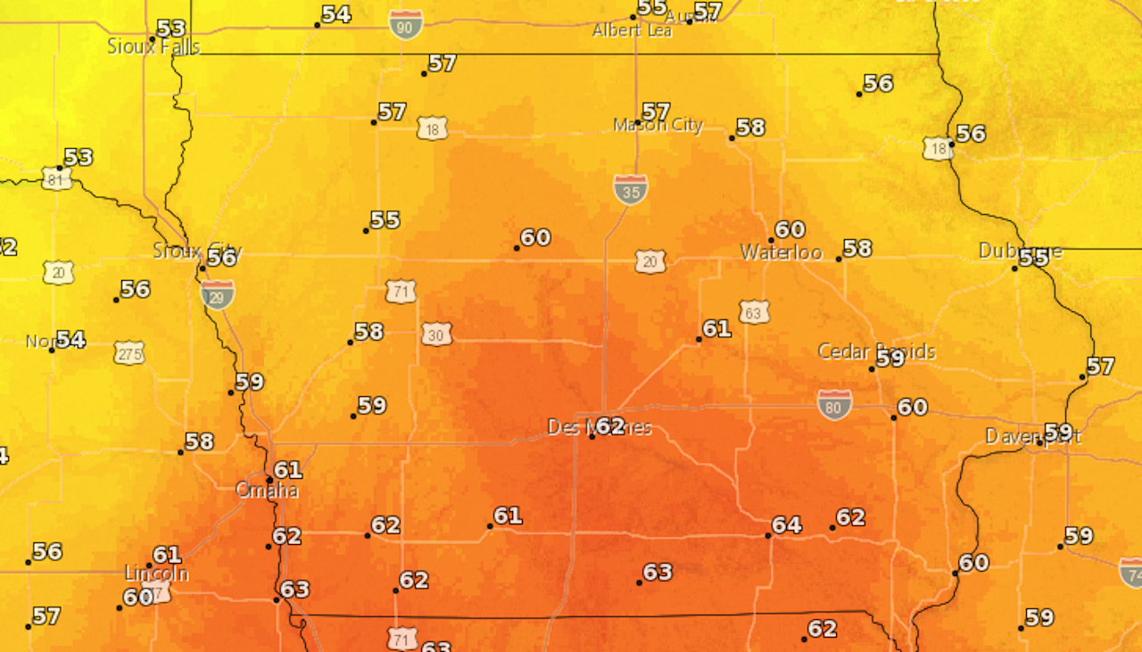
The key player in this weather shift is a developing low-pressure system over eastern Colorado. As it moves northeastward, it will usher in a surge of warmer temperatures for Wednesday through Friday. Thanks to southerly flow, temperatures are expected to rise into the 50s, with areas south of Highway 30 reaching the lower 60s on Thursday.
Potential Record Breakers
There will even be the potential to set record highs on Thursday afternoon, and record warm lows Wednesday morning and then again Thursday morning across the state of Iowa. Below are a couple of examples from Des Moines and Cedar Rapids of the possible records that will be challenged this upcoming week.
Des Moines
| Day | Forecast | Record | Year |
| Wednesday Morning | 40 | 34 | 1928 |
| Thursday Morning | 48 | 43 | 1966 |
| Thursday Afternoon | 62 | 60 | 1999 |
Cedar Rapids
| Day | Forecast | Record | Year |
| Wednesday Morning | 36 | 36 | 1966 |
| Thursday Morning | 47 | 43 | 1966 |
| Thursday Afternoon | 59 | 57 | 1925 |
Rainy Interlude
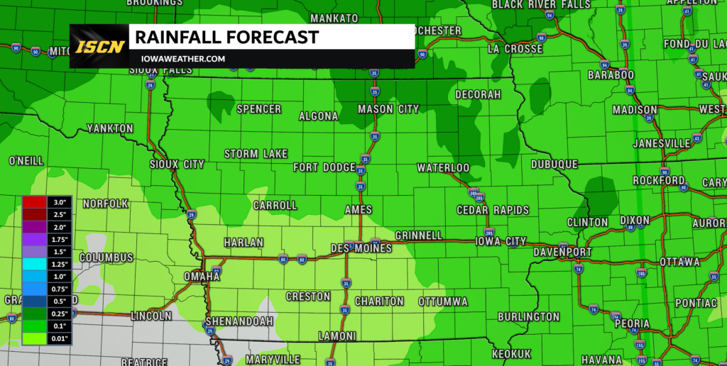
Alongside the temperature rise, rain chances are on the horizon. Increased moisture transport, aided by a strong low-level jet, will lead to rain chances, particularly on Thursday. Rain will likely begin late Wednesday evening and will continue through the day on Thursday, before eventually coming to an end by early Friday.
There will be the potential for a few rumbles of thunder Thursday afternoon across central to southern Iowa as various models suggest modest CAPE values. As for total rainfall, amounts will range from 0.1″ to 0.25″.

Windy Conditions
It should also be noted, that as the system approaches, southerly winds will strengthen, with gusts reaching 25 to 35 mph on Thursday. Wednesday won’t be left out, with gusts of 15 to 25 mph making for a breezy day.
As this weather system eventually lifts to the northeast on Friday, any lingering precipitation will come to an end, with temperatures returning back into the 40s for the weekend. Stay tuned, stay safe, and brace yourselves for a brief, but potentially record-breaking, shift in the weather pattern!