Multiday Severe Weather Threat in Iowa
A cold front is making its way towards northern Iowa today, originating from Canada. As it approaches, we can expect changes in the weather pattern. Cloud cover will increase this afternoon, and winds near the front will intensify. This cold front will bring multiple chances for strong to severe storms beginning Monday evening and continuing through Wednesday.

Monday’s Severe Weather Threat
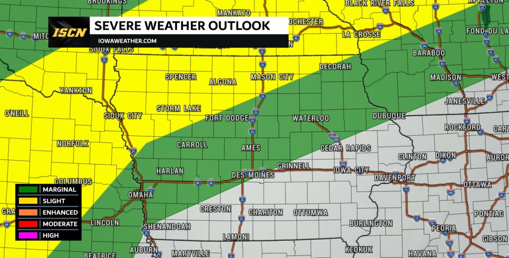
One of the significant effects of the approaching cold front will be the formation of thunderstorms. These storms are expected to develop along the front in Minnesota and gradually move into Iowa during the late afternoon and evening hours on Monday. The timing looks to be primarily after 6PM and diminishing by 11PM. These thunderstorms will pose the risk of strong winds and hail up to golf ball sized.

Tuesday’s Severe Weather Threat
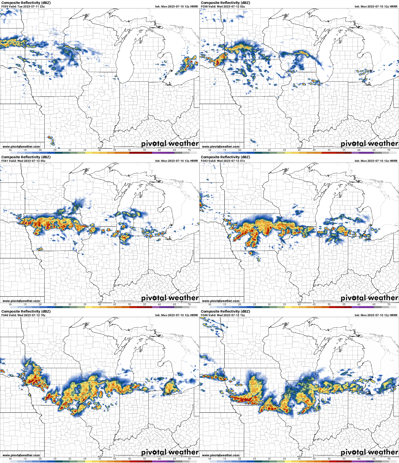
As the day progresses, the cold front will likely stall somewhere across Iowa. The exact placement of this front will be crucial in determining the path of the thunderstorms that may occur during the night. Several factors complicate the front’s position, such as cold air pockets from Monday evening storms, and the possibility of rain developing along the front throughout the day.

What looks to occur Tuesday night will be that thunderstorms will move along the boundary created by the front. Weather models show disparities in the timing and location of these storms, but they generally suggest the potential for more than one cluster of storms. One cluster could be elevated in northern Iowa, while another may form near the instability gradient. The primary severe threats with these storms will be damaging wind gusts and large hail. While the threat is low, there will be the potential for a low-end embedded tornado threat along this line of storms.

Wednesday’s Severe Weather Threat
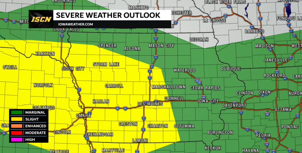
The complex of storms will continue to exit the state through Wednesday. Large hail and damaging wind gusts will continue to be the main hazards with these remaining storms. Due to this threat, a slight risk of severe weather will exist across primarily the southern half of Iowa.

Rainfall Forecast for Iowa
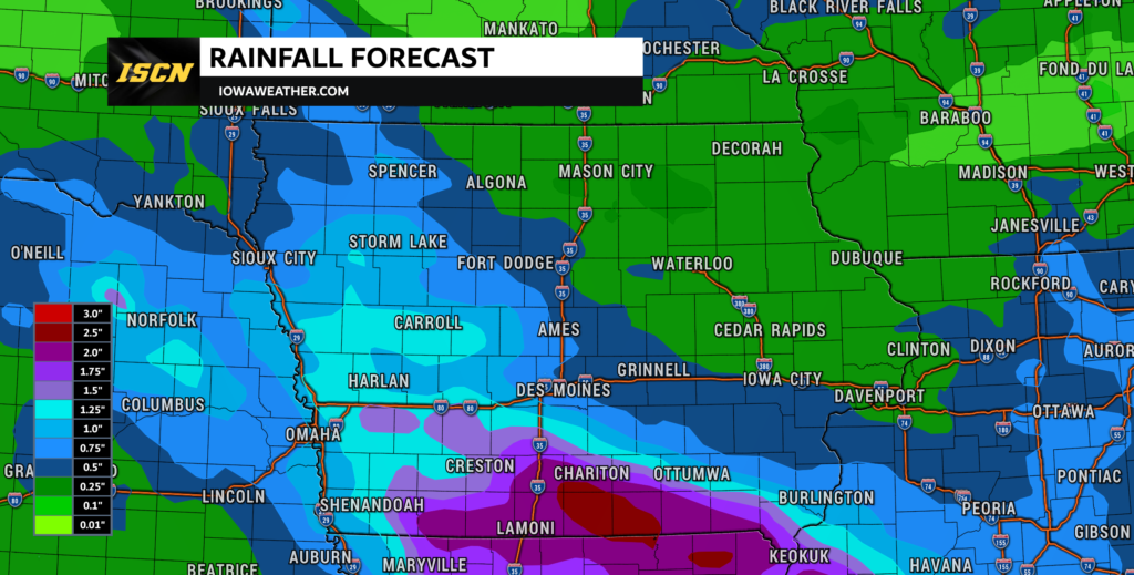
Over the next few days, the heaviest rainfall looks to occur across the southern half of Iowa. This is where a half-inch up to two or more inches will be possible. This rainfall comes at a time where the drought conditions continue to worsen in the state of Iowa. While this rainfall will not be a drought buster, it will certainly help.
Keep an eye on weather updates by having our ISCN Weather app installed. We will continue to monitor the situation and will continue to provide further updates.