Possible Winter Storm in Iowa Later This Week

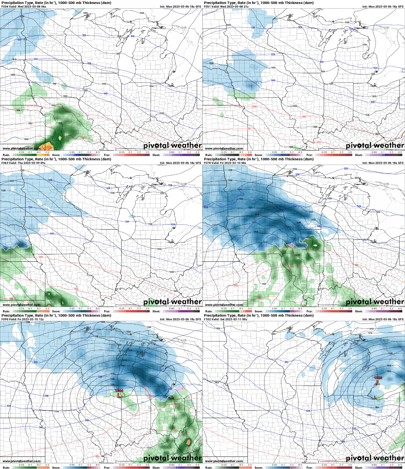
As we move into the first full week of March, a troughing pattern will bring a series of shortwaves that will create an active weather pattern for the state of Iowa. Precipitation will begin to increase Tuesday evening, with most of the precipitation mainly focused in western Iowa. A dry slot will limit the eastern extent of the precipitation, and the precipitation will generally be light as the higher moisture content will be tied to a front in Missouri.
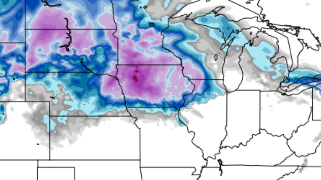
This light precipitation will continue into the day on Wednesday in the form of a wintry mix. As we head into Thursday, we will see the weather pattern intensify as a more potent shortwave ejects in from the west. The GFS and Euro models differ in intensity, with the GFS continuing to eject a closed low across the Northern Plains, yielding higher snow amounts.

There still remains low confidence on amounts and placement, as much will depend on how far northwest the system will move and whether precipitation will fall as rain or snow. As of Monday afternoon, the latest weather forecast would place the greatest chance for accumulating snow along and north of Interstate 80.
Winter storm criteria could be met in far northern Iowa, so it is possible for the need for a winter storm watch. The system will then begin to depart on Friday, but some wrap-around snow showers will be possible throughout the day on Friday.
Heading into the weekend, another clipper system will arrive on Saturday, bringing another chance of rain and accumulating snow. This clipper system looks to bring accumulations less than the system on Thursday. If you have any travel plans during this timeframe, it is essential to keep up with the latest forecasts and stay informed about any potential weather impacts.
Be sure to download our free ISCN Weather App to check your local weather forecast on the go. The app will also send you push notifications as soon as any watches, advisories, or warnings are issued for your current location.
