Post-Thanksgiving Winter Storm Likely to Impact Midwest Travel

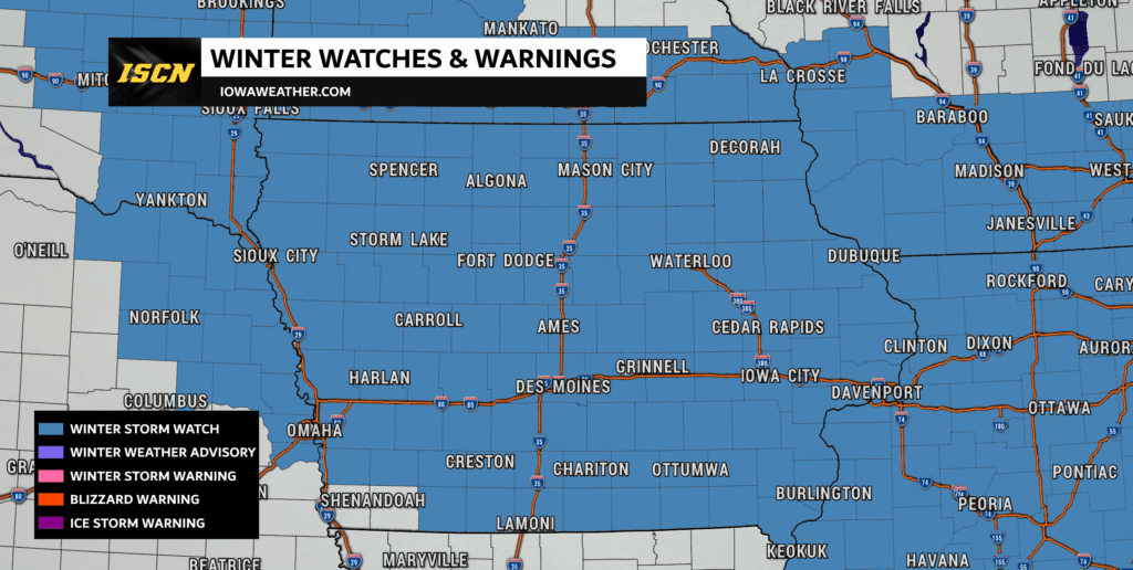
A major winter storm is quickly taking shape for the Midwest as millions prepare to head home after Thanksgiving. With a large swath of the region now under Winter Storm Watches, confidence is increasing that moderate to heavy snow, icy conditions, and dangerous travel will impact Iowa and surrounding states from late Friday through Saturday night.
This storm is expected to be one of the most impactful early-season winter systems in several years.
Confidence Increasing: Moderate Winter Impacts Likely for Much of Central & Eastern Iowa
Forecast trends continue to point toward a high-impact winter storm, especially for areas along and north of I-80. According to the latest probabilistic guidance, the likelihood of moderate winter impacts—including hazardous travel, snow-covered roads, and possible infrastructure disruptions—is now 60% or higher across central and eastern Iowa.
This includes Des Moines, Ames, Marshalltown, Waterloo, Cedar Falls, Iowa City, Cedar Rapids, and many surrounding communities.
Timing:
This will be a long-duration snowfall event. The core of the storm will move through the region from:
Friday afternoon/evening → Saturday night
- Northwest Iowa: Snow arrives Friday afternoon
- Central Iowa: Snow fills in Friday evening
- Eastern Iowa: Snow spreads in late Friday night into early Saturday
- All of Iowa: Periods of snow continue through Saturday night
- Lingering impacts: Roads may remain slick into Sunday morning, even after the snow ends

Snow Totals:
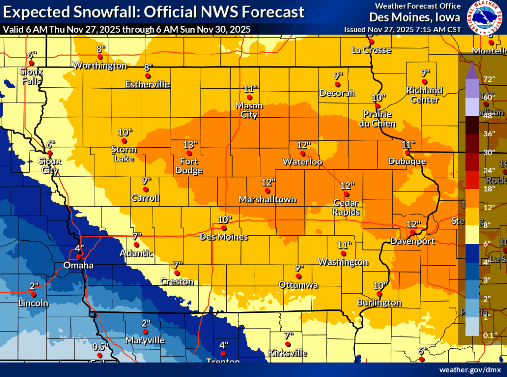
Forecast confidence in significant snow accumulation is rising. Many areas are now favored to receive:
- 6–14 inches in central, eastern, and northern Iowa
- 2–5 inches across southwest Iowa and eastern Nebraska
However, southern Iowa may mix with rain at times on Saturday, which could limit snow totals in places such as Lamoni, Centerville, Corydon, Chariton, and Bloomfield.
Even in these areas, impacts remain possible due to reduced visibility, slushy roads, and potential refreeze Saturday night.
The potential for a high-impact winter storm is growing, with the latest data suggesting more significant snow totals and travel disruptions than previously expected. While some uncertainty remains—particularly regarding the rain/snow line in southern Iowa—the message is clear:
If you have post-Thanksgiving travel plans, now is the time to plan ahead, adjust your timing if needed, and stay closely tuned to the forecast.
ISCN will continue providing updated maps, live forecasts, radar analysis, and storm coverage as the system approaches.