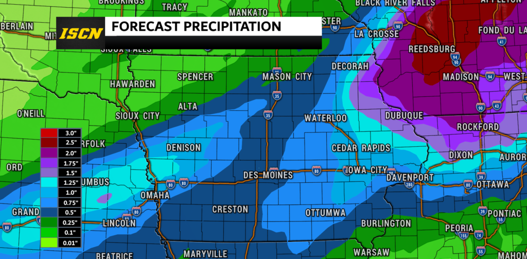
A cold front will bring the chance for showers and thunderstorms from Friday through Sunday. Based on the latest model guidance as of Friday morning, the cold front will be moving through the state faster than it was originally forecast to. So this will clear the rain out of the state quicker, but will unfortunately lower rainfall amounts.
Rainfall Timing:
The cold front will begin to move into northwest Iowa Friday morning with scattered showers and thunderstorms possible by early afternoon. This front will continue to drop to the southeast throughout the afternoon and evening. Rain will be likely from northeast Iowa through central and southwest Iowa during the day on Saturday. The front will continue to move to the southeast through Saturday night into Sunday. Rain will then exit the eastern part of the state by Sunday mid-day.

Rainfall Amounts:
The greatest rainfall amounts are currently forecast to fall across northeast Iowa. This is where total rainfall amounts of 1″ to 2″ will be possible through Sunday. Elsewhere across the state of Iowa, a half-inch up to an inch of rainfall will be possible. Flooding will not be a concern due to how quickly this system will exit the state.
Temperatures
Highs on Saturday will be in the 60s, with the exception of southeast Iowa. This is where highs will be in the 70s to 80s. On Sunday, highs will be in the 70s for most of the state, with the 60s across northeast Iowa. High temperatures will slowly warm back towards seasonal averages by next week, but look to start the week below average.

Drought Conditions
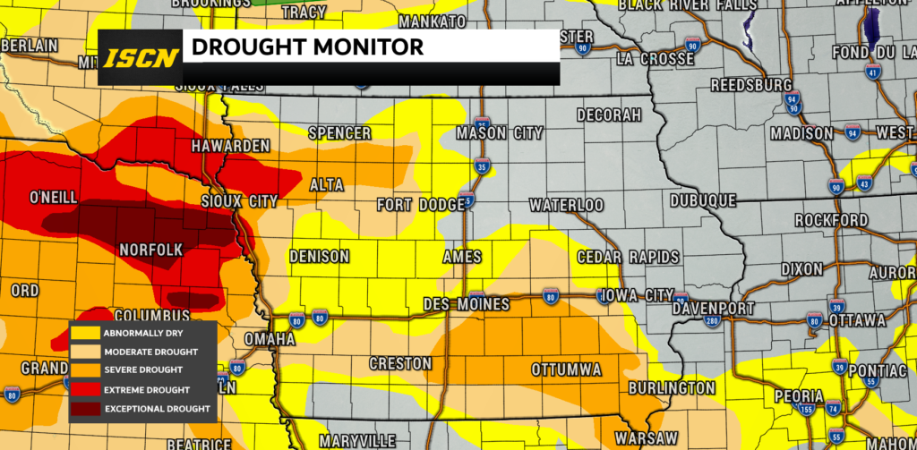
The latest drought monitor was released Thursday morning. Very little change occurred in the outlook since last week, with still over 62% of the state in some form of a drought. The worst of the drought conditions are across extreme northwest Iowa, and this is where extreme drought conditions exist.
Be sure to have our free ISCN Weather app downloaded to receive the latest weather forecasts.