Thunderstorms and Heavy Rainfall Expected This Weekend Across Iowa

This Friday, the weather pattern is expected to change across the Midwest. A weather disturbance, known as a mid/upper shortwave trough, is set to move eastward across the region. This is a type of atmospheric pressure system that can often lead to stormy weather.
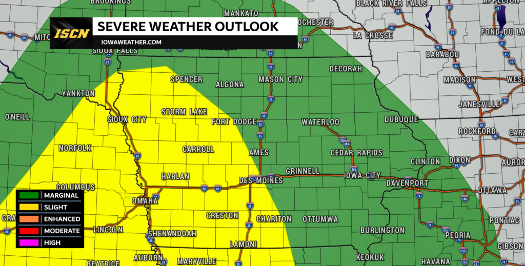
Severe Thunderstorm Potential Saturday
A low-pressure system will move from South Dakota to Iowa, heading east and slightly south. Following this, a cold front (a boundary separating cold and warm air) will form and move southeast across the central Plains towards Iowa and Missouri.
However, there are some differences in the timing and location of these weather systems according to various weather models. Despite these discrepancies, the overall pattern suggests an increased likelihood of severe thunderstorms developing ahead of the low-pressure system and the cold front, particularly across parts Kansas up through eastern Nebraska and western Iowa.
Despite the timing uncertainty, the region is expected to be very humid and unstable, which are perfect conditions for thunderstorms. Any storms that do develop ahead of the cold front could bring large hail and damaging wind gusts.
Overnight Saturday Risk
During the evening and overnight, an increasing southwesterly low-level jet (a region of strong winds in the atmosphere) may help maintain a severe thunderstorm complex, known as a Mesoscale Convective System (MCS), moving eastward across Iowa, towards the Mid-Mississippi Valley by Sunday morning. In addition to the risk of hail and damaging winds, there’s also some potential for tornadoes, particularly near the low-pressure system.

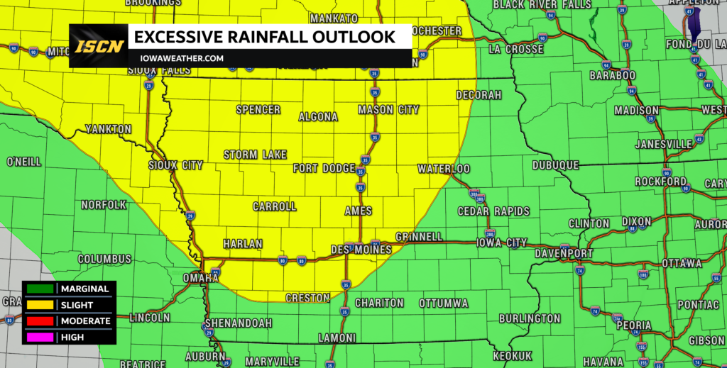
Heavy Rainfall Potential
This weather disturbance, along with the eastward movement of strong upper-level winds (known as jet streaks), will create favorable conditions for heavy rainfall. The moisture content in the atmosphere is expected to be 3 to 4 times above normal, which will contribute to this. The Weather Prediction Center has issued a slight risk of heavy rainfall for this area, which includes portions of northern into central Iowa. The latest non-weather model guidance already suggests areas could receive 2-4 inches of rainfall or more.

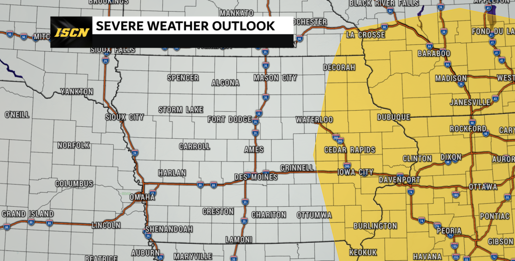
Sunday Severe Threat
As the low continues to deepen as it moves to the east, and the cold front continues across the state, additional thunderstorms will likely develop by Sunday afternoon across eastern Iowa. All modes of severe weather will be possible. The greatest tornado threat once again near the surface low, which will likely be near northeast Iowa into southwest Wisconsin and will continue to track to the east along the Illinois/Wisconsin border.
Stay tuned to IowaWeather.com for the latest weather forecasts for the most up-to-date information.