Iowa residents can expect a quiet stretch of November weather over the next several days, with chilly temperatures, plenty of sunshine, and little concern for rain or snow through the weekend. Afternoon highs will generally remain in the upper 30s and 40s, while overnight temperatures fall into the teens and 20s in many communities. Despite the colder conditions, the lack of precipitation should make this a favorable weekend for outdoor activities and travel across much of the state.
The bigger change arrives next week as a warming trend pushes temperatures back into the 50s, with some locations potentially approaching or exceeding 60 degrees by Wednesday. This warmer weather will develop as the atmosphere shifts away from the colder northwest flow that has dominated the region recently. The first half of the workweek should remain mostly dry, giving Iowa several more days of relatively calm weather.
By Wednesday and Thursday, however, attention will turn toward a developing storm system over the Plains that could bring the next opportunity for rainfall. The exact timing and coverage remain uncertain, but there are growing indications that the weather pattern could become more active heading toward the week of Thanksgiving.
Weekend Forecast: Cold Mornings, Sunshine, and Dry Conditions
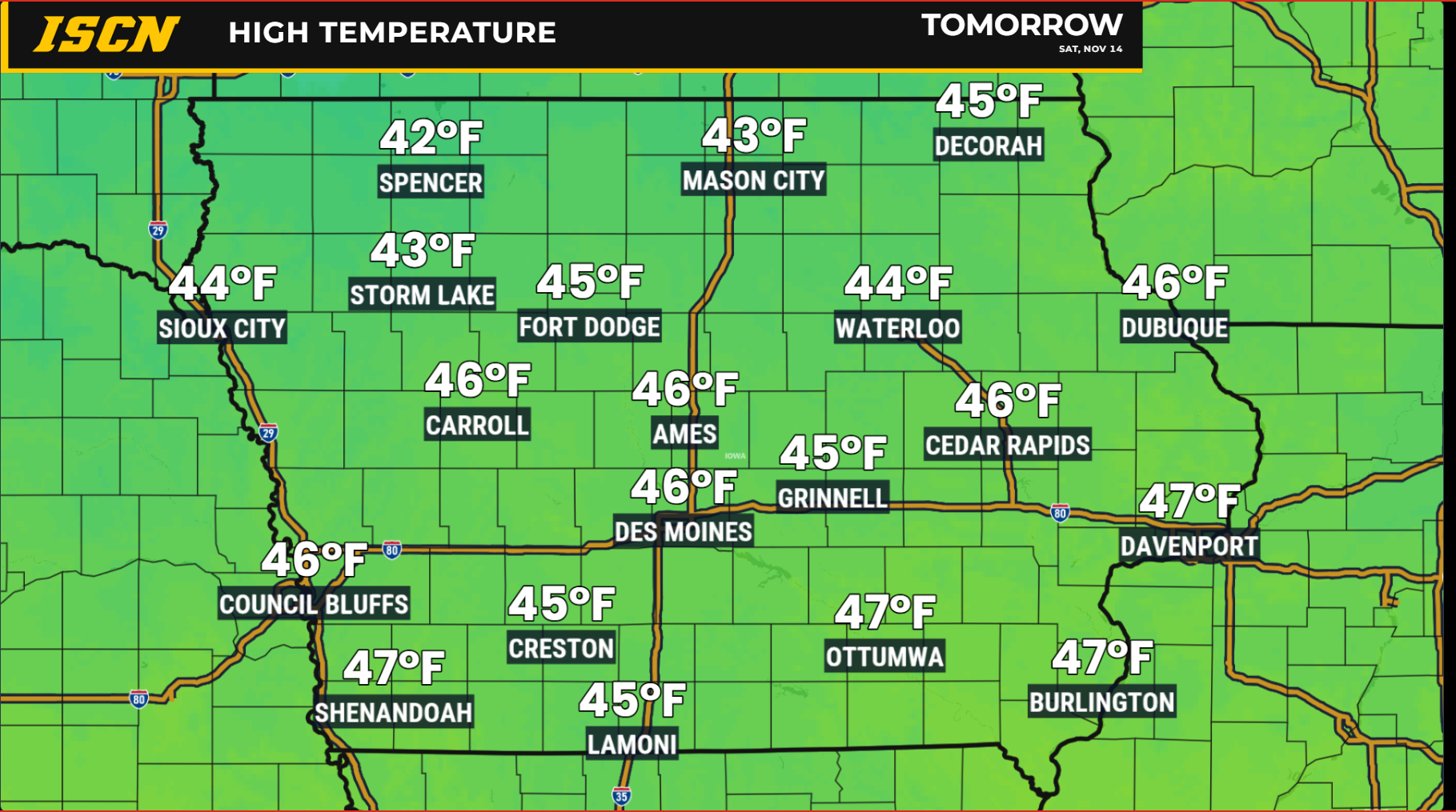
Saturday and Sunday will bring a continuation of the quiet weather pattern, with seasonably cool temperatures and little chance of precipitation anywhere in Iowa. Morning lows will be especially chilly, with northern Iowa communities potentially dropping into the upper teens while much of central and southern Iowa falls into the lower to middle 20s. These temperatures will be cold enough for widespread freezing conditions, so anyone spending time outdoors early in the morning should plan accordingly. Afternoon temperatures will gradually recover into the 40s, with some locations in western Iowa potentially reaching the lower 50s as warmer air begins moving into the region. Sunshine should be plentiful across central and eastern Iowa, although portions of western Iowa may experience more cloud cover at times. Overall, the weekend forecast looks favorable for outdoor plans, provided residents are prepared for the cold mornings.
One noticeable difference across the state could be the wind, particularly in northwest Iowa. As high pressure moves east, southerly winds will gradually strengthen across western and northwestern portions of the state. Wind gusts of 25 to 35 mph are possible in the northwest on Saturday and Sunday, which could make otherwise improving afternoon temperatures feel cooler. Central and eastern Iowa should generally experience less wind as the weekend begins, although southerly winds may become more noticeable with time. The combination of sunshine, dry conditions, and gradually increasing temperatures should make Sunday feel somewhat milder than Friday in many communities. Confidence remains high in the overall dry weekend forecast, with the greatest regional differences involving cloud cover and wind speeds.
Significant Warming Trend Arrives Early Next Week
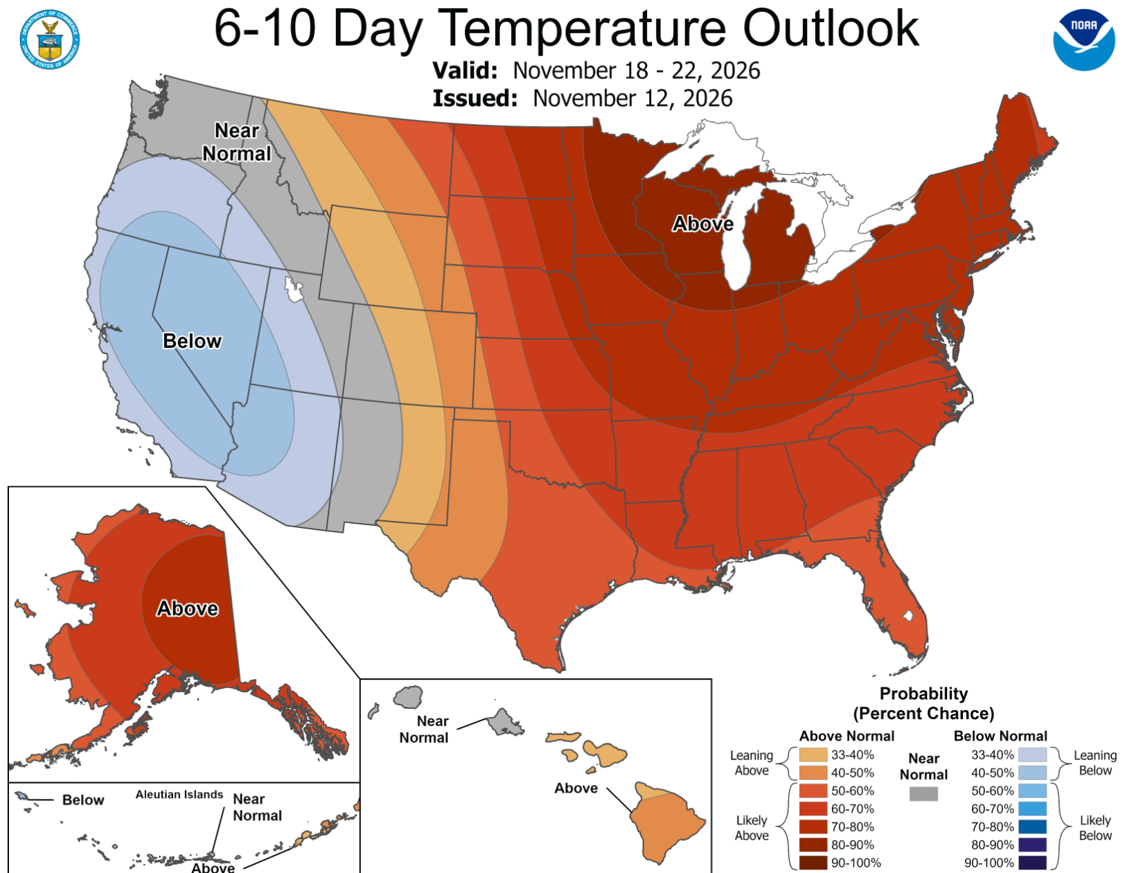
A noticeable change in Iowa’s weather will begin Monday as warmer air starts spreading northward across the central United States. Afternoon temperatures should climb into the upper 40s and lower 50s across much of the state, marking the beginning of a steady warming trend. By Tuesday, highs in the 50s will become more widespread, with some communities reaching the middle or upper 50s. Wednesday currently appears to offer another opportunity for mild temperatures, with highs generally in the 50s and some locations potentially reaching 60 degrees or slightly warmer. Western and southern Iowa may have the best opportunity for the warmest readings, although the final temperature distribution will depend on cloud cover and the timing of the next approaching weather system. These temperatures would be above average for the middle of November, especially following the chilly conditions expected this weekend.
The warming trend will develop as a large ridge of high pressure builds over the central United States. This feature represents an area of higher atmospheric pressure several miles above the ground and often supports warmer, more stable weather. As the ridge shifts eastward, winds closer to the surface will turn more southerly and transport milder air into Iowa. Overnight temperatures will also respond, gradually climbing out of the teens and 20s toward the 30s and potentially lower 40s in some locations by the middle of the week. This should provide a welcome break from the colder mornings, particularly for residents working outdoors or traveling during the early morning hours. Confidence is high in the overall warming trend, although the exact temperatures Wednesday will depend on how quickly clouds and precipitation approach.
Dry Weather Continues Into the First Half of the Workweek
Anyone wondering whether rain will interrupt plans Monday or Tuesday can expect the generally dry pattern to continue. The developing ridge of high pressure will help limit the formation of widespread clouds and precipitation across Iowa. While periods of cloud cover are possible, especially as the next weather system begins organizing to the west, most communities should experience favorable conditions for travel and outdoor activities. This extended dry period will follow several days of relatively quiet weather during the weekend, creating a prolonged stretch without meaningful precipitation. The combination of milder temperatures and limited rain chances could be beneficial for remaining outdoor projects and agricultural work.
Winds will become an increasingly important part of the forecast as the warming trend develops. Southerly winds are expected to strengthen at times, particularly across western and northwestern Iowa, as pressure differences increase ahead of the approaching storm system. These winds will help transport warmer air and eventually additional moisture into the region. Although mild temperatures and stronger winds can sometimes increase fire weather concerns, current guidance does not indicate a widespread significant fire weather threat during the early part of the week. Residents should still use caution with outdoor burning, especially where vegetation remains dry and winds become gusty.
Rain Chances Return Wednesday and Thursday
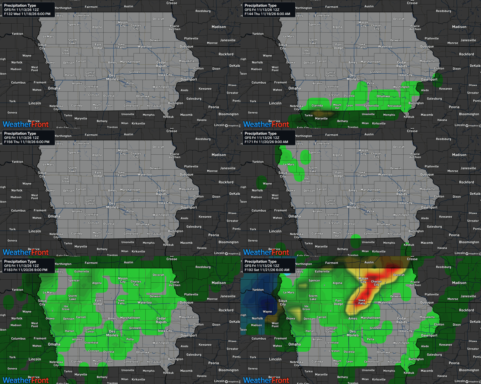
The next meaningful opportunity for precipitation across Iowa is expected to develop around Wednesday or Thursday as a storm system approaches from the western United States. This system is forecast to organize over the Rockies and Plains before moving northeastward, bringing increasing moisture into the central part of the country. As the system approaches, a cold front and other atmospheric disturbances could provide the lift needed to produce scattered or more widespread rain showers. Western Iowa may see precipitation opportunities begin as early as Wednesday, while portions of central and eastern Iowa could have better chances Wednesday night into Thursday. However, the exact timing remains uncertain because forecast models continue to show differences in the storm’s eventual track and strength.
The greatest uncertainty involves how far north the main storm system and its associated moisture will travel. Some forecast guidance suggests a more northern track that would bring precipitation into a larger portion of Iowa, while other solutions favor a more southern route. A southern track could leave northern and eastern Iowa with less rainfall, even if areas farther south receive more substantial precipitation.
Stay connected with IowaWeather.com for the latest Iowa weather forecast, local conditions, radar updates, and information about developing weather systems. You can also follow the Iowa Storm Chasing Network and use the ISCN Weather app to keep up with changing conditions across the state.