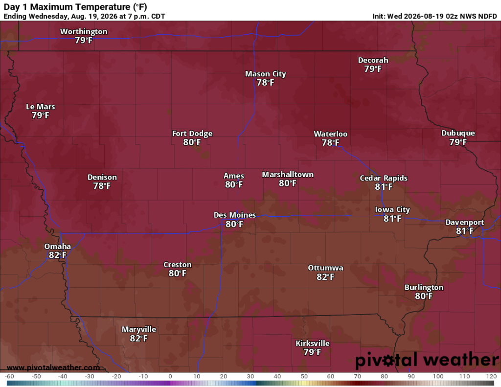
Iowa will remain in an active but relatively mild weather pattern Wednesday through the end of the week. Scattered showers and thunderstorms are possible Wednesday, especially across western and southern Iowa, but the threat for severe weather is low. Many locations will stay dry for much of the day with highs generally in the upper 70s to lower 80s.
A quieter period arrives Wednesday night into Thursday before another cold front brings increasing thunderstorm chances Thursday night and Friday. After that system moves through, Saturday currently looks like the best day of the weekend for outdoor plans.
Scattered Storms Possible Wednesday
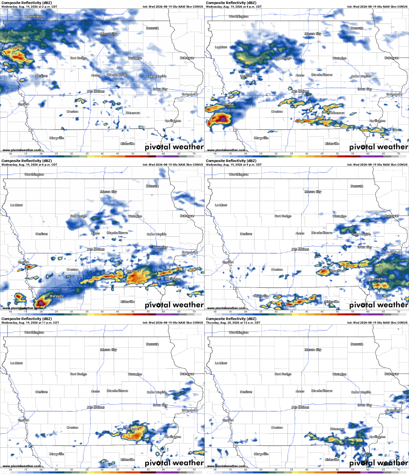
Scattered showers and thunderstorms could move through portions of southern Iowa early Wednesday morning, with additional development possible across western and southwestern Iowa during the day. Eastern Iowa could also see lingering morning showers or thunderstorms, particularly south of Interstate 80, before activity gradually decreases. Rain is not expected to be widespread or continuous, so many Iowa communities will experience plenty of dry time. The highest overall rain chances favor western and southwestern portions of the state.
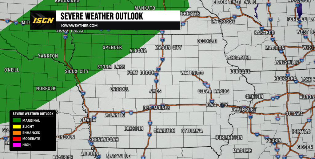
The severe weather threat Wednesday is low. An isolated stronger thunderstorm could produce gusty winds or hail in southwest Iowa, but the better environment for severe storms should remain southwest of the state. Widespread damaging winds, large hail or tornadoes are not expected based on the current setup. High temperatures Wednesday should generally reach the upper 70s to lower 80s, keeping conditions comfortable for August.
Quieter Thursday Before Storms Return
Wednesday night into much of Thursday should provide a break from the unsettled weather as high pressure moves across the region. Most of Iowa should remain dry during the daytime Thursday, with temperatures again reaching the upper 70s and 80s. Sunshine should become more widespread, making Thursday one of the better days this week for outdoor activities.
The next disturbance and cold front will approach Thursday evening, causing thunderstorm chances to increase first across northwest Iowa. Instability could become stronger near the front, meaning a few stronger thunderstorms may be possible Thursday night. Large hail and locally strong winds would be the main concerns if stronger storms develop, although the better severe weather environment may remain north of Iowa. Confidence in widespread severe weather across the state remains low.
Rain and Thunderstorms Return Friday
Showers and thunderstorms should become more common Thursday night into Friday as the cold front crosses Iowa. Western and northern Iowa appear to have the better rain chances initially, with precipitation potentially spreading farther across the state during Friday. It will not rain everywhere throughout the day, and there remains uncertainty regarding exactly where the greatest coverage develops.
Heavy rainfall and flooding do not currently appear to be significant concerns because deep moisture will remain somewhat limited. Friday could also be slightly warmer ahead of the front, with highs generally in the 80s where clouds and rain do not arrive early. Cooler and drier air should begin filtering into Iowa behind the front later Friday into Friday night.
Pleasant Weather Favored Saturday
Saturday currently looks like the best day of the weekend across Iowa. Most of the state should experience dry weather with sunshine and comfortable temperatures near 80 degrees. Humidity should remain manageable, and there is no indication of significant August heat returning during the weekend.
A small chance for showers or thunderstorms could return by Sunday as another disturbance moves through the northwest flow pattern. Rain coverage currently looks limited, however, meaning considerable dry time remains possible Sunday. Temperatures should remain seasonable in the lower to middle 80s.
Stay with IowaWeather.com for updated Iowa weather forecasts, storm timing, radar and severe weather information as the forecast evolves.